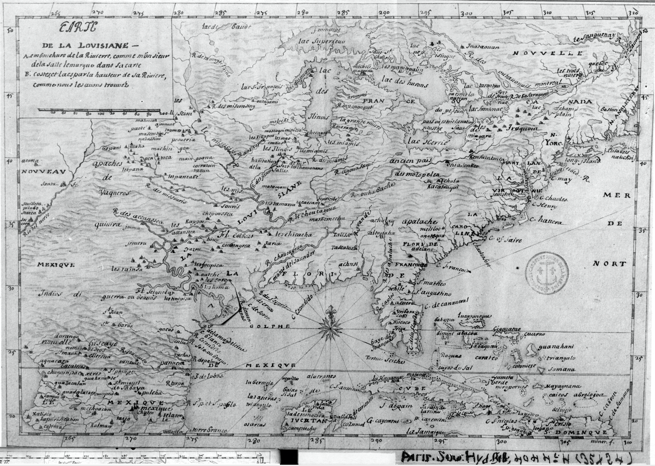

1683 LaSalle, Carte de la Louisiane
This map, associated with Jean-Baptiste Minet and the year 1685, is better attributed to La Salle, 1683. Well documented in the Newberry Ayer catalogue that the map (as Minet 1685) was based on Franquelin's 1684 map of North America, and further documented on the Franquelin Map Cartouche, itself, is that the map was based on La Salle's voyages and discoveries.
- Date
- 1684
- Mapmaker / publisher
- La Salle
- Place
- North America
- Archive
- Wikimedia Commons
- Type
- map
- Original size
- 655 × 466 pixels
Public domainsafest
Reason: its maker died more than 70 years ago.
Read from: Commons licence category: PD-old-70-expired; no CC BY, CC BY-SA, GFDL or deletion tag on the file page.
Credit line
"1683 LaSalle, Carte de la Louisiane" (1684). La Salle, via Wikimedia Commons. Public domain. https://commons.wikimedia.org/wiki/File:1683_LaSalle,_Carte_de_la_Louisiane.pngNeed maps for a whole project? Add Find Any Map to Claude and ask for this one by its id: 293755.
More like this

1674 Carte de La Louisiane (1900 Jesuit Relations edition)
1674 · Wikimedia Commons

Carte de la Nouvelle France et de la Louisiane nouvellement découverte
1683 · Wikimedia Commons

Marquette and jolliet map 1681
1681 · Wikimedia Commons

Carte de la Nouuelle France et de la Louisiane nouuellement découuerte dediée au Roy lan 1683
1683 · Wikimedia Commons

La salle expedition
Wikimedia Commons

Carte de la Louisiane en l'Amérique septentrionale, depuis la Nouvelle France jusqu'au golfe du Mexique, où sont décris les pays que le sieur de La Salle a découverts dans un grand continent compris depuis 50 degr. de l'elevation du Pole jusques à 25', les années 1679, 80, 81, 82 / par Jean-Baptist
1684 · Wikimedia Commons

Claude Bernou Carte de lAmerique septentrionale
c. 1681 · Wikimedia Commons

The Mississippi
1682 · Library of Congress