

Marquette and jolliet map 1681
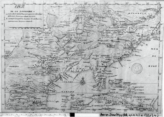
ca. 1681 map of the Mississippi River system, based on the 1673 expediton of Jacques Marquette and Louis Jolliet. This is one of many early maps made based on their descriptions of the interior of North America.
- Date
- 1681
- Mapmaker / publisher
- probably drawn by Melchisédec Thévenot based on earlier Marquette map
- Place
- North America
- Archive
- Wikimedia Commons
- Type
- map
- Original size
- 2,056 × 860 pixels
Public domainsafest
Reason: its maker died more than 100 years ago.
Read from: Commons licence category: PD-old-100-expired; no CC BY, CC BY-SA, GFDL or deletion tag on the file page.
Credit line
"Marquette and jolliet map 1681" (1681). probably drawn by Melchisédec Thévenot based on earlier Marquette map, via Wikimedia Commons. Public domain. https://commons.wikimedia.org/wiki/File:Marquette_and_jolliet_map_1681.jpgNeed maps for a whole project? Add Find Any Map to Claude and ask for this one by its id: 295975.
More like this

Geography 063 - First map of the Mississippi River
1673 · Wikimedia Commons

The Mississippi
1682 · Library of Congress

Carte de la découverte faite l'an 1673 dans l'Amérique septentrionale.
1681 · Library of Congress
1683 LaSalle, Carte de la Louisiane
1684 · Wikimedia Commons

Claude Bernou Carte de lAmerique septentrionale
c. 1681 · Wikimedia Commons

Carte de la decouverte faite l'an 1673 dans l'Amerique Septentrionale
1681 · Library of Congress

Nouvelle decouverte de plusieurs nations dans la Nouvelle France en l'année 1673 et 1674.
1896 · Library of Congress

Darlington map of the mississippi river 1680
1680 · Wikimedia Commons