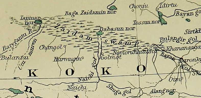

Zaidam Swamp
The marsh of the Qaidam Basin ("Zaidam Swamp"), with names given using Chinese Postal Romanization.
- Date
- 1917
- Mapmaker / publisher
- Edward Stanford
- Place
- China
- Archive
- Wikimedia Commons
- Type
- atlas page
- Original size
- 787 × 384 pixels
Public domainsafest
Reason: its maker died more than 70 years ago.
Read from: Commons licence category: PD-old-70-expired; no CC BY, CC BY-SA, GFDL or deletion tag on the file page.
Credit line
"Zaidam Swamp" (1917). Edward Stanford, via Wikimedia Commons. Public domain. https://commons.wikimedia.org/wiki/File:Zaidam_Swamp.pngNeed maps for a whole project? Add Find Any Map to Claude and ask for this one by its id: 242388.
More like this

NJ 47 Hsi-ning
1975 · Wikimedia Commons

NJ-46 Ko-erh-mu
1975 · Wikimedia Commons

Mansarovar map
1915–1922 · Wikimedia Commons

Map from the International Map of the World 1:1,000,000
Wikimedia Commons

Map from the International Map of the World 1:1,000,000 (From map: "THE DELINEATION OF INTERNATIONAL BOUNDARIES ON THIS MAP MUST NOT BE CONSIDERED AUTHORITATIVE.")
Wikimedia Commons

Map of Tibet (Thibet) in 1878, from- EB9 China
1878 · Wikimedia Commons

Der Jesuiten-Atlas der Kanghsi-Zeit - China und die Aussenlaender
1708–1941 · Qinghai, plate 18

China, administrative divisions
1969 · Qinghai, plate 24