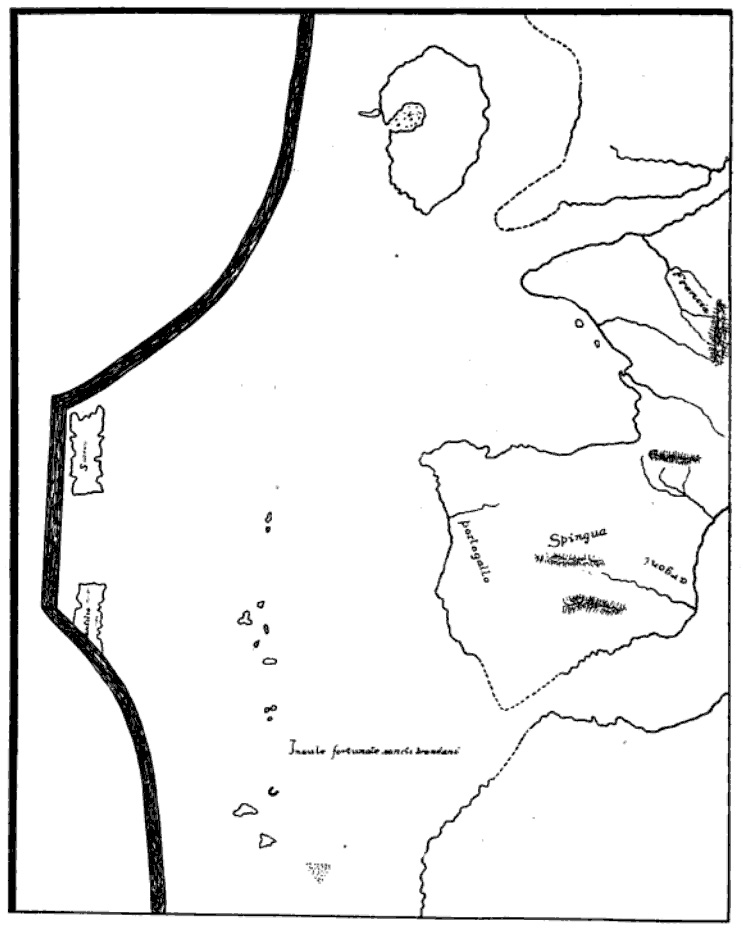

Weimar map (Atlantic islands detail)
Sketched of a portion the w:Weimar map, an anonymous 15th C. Italian portolan held by the Grand Ducal Library in Weimar. Sometimes dated 1424, although more recent historians believe it was composed sometime between 1460s and 1490s, probably by the cartographer Conte di Ottomano Freducci of Ancona, or one of his relatives. This particular sketch, showing only part of the portolan (focused on the central Atlantic islands, esp. the fictional island of Antillia) was made by William Henry Babcock (d.1922) from Weimar library photographs and published in his 1917 article "Indications of Visits of White Men to America before Columbus", in F.W. Hodge, editor, Proceedings of the Nineteenth International Congress of Americanists, Washington, DC., p.476.
- Date
- 1424–1499
- Mapmaker / publisher
- (poss. Conte di Ottomano Freducci)
- Place
- phantom islands
- Archive
- Wikimedia Commons
- Type
- chart
- Original size
- 744 × 932 pixels
Public domain
Reason: its maker died long enough ago that the copyright has expired.
This status rests on the map's publication history, as researched by Wikimedia Commons. Check it before commercial use.
Read from: Commons licence category: PD Old; no CC BY, CC BY-SA, GFDL or deletion tag on the file page.
Credit line
"Weimar map (Atlantic islands detail)" (1424–1499). (poss. Conte di Ottomano Freducci), via Wikimedia Commons. Public domain. https://commons.wikimedia.org/wiki/File:Weimar_map_(Atlantic_islands_detail).jpgNeed maps for a whole project? Add Find Any Map to Claude and ask for this one by its id: 141782.
More like this

Albino de Canepa 1489
1489 · Wikimedia Commons

Pareto 1455
1455 · Wikimedia Commons

Hand copied segment of original sea chart
1436 · Wikimedia Commons

Benincasa 1476
1476 · Wikimedia Commons

Corbitis Atlas (Azores detail)
1384–1410 · Wikimedia Commons

Weimar 1527
1527–1900 · 2 sheets

Nautical chart of the Mediterranean area, including Europe with British Isles and part of Scandinavia. HM 1548. anonymous, PORTOLAN CHART (Italy, 15th century).N
1492 · Wikimedia Commons

Ruysch map, Gruenlant-Antilia
1507 · Wikimedia Commons