

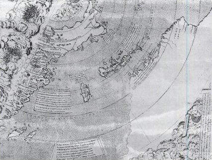
Ruysch map, Gruenlant-Antilia
Close up of the Ruysch map (1507) showing Gruenlant, Isle of Demons, Newfoundland, Antilia, Cuba, and the coast of South America
- Date
- 1507
- Mapmaker / publisher
- Johann Ruysch († 1533), scanned by Kimon Berlin, user:Gribeco
- Place
- the Caribbean
- Archive
- Wikimedia Commons
- Type
- map
- Original size
- 1,500 × 1,500 pixels
Public domain
Reason: its maker died long enough ago that the copyright has expired.
This status rests on the map's publication history, as researched by Wikimedia Commons. Check it before commercial use.
Read from: Commons licence category: PD Old; no CC BY, CC BY-SA, GFDL or deletion tag on the file page; permission field: reproduction of public domain work.
Credit line
"Ruysch map, Gruenlant-Antilia" (1507). Johann Ruysch († 1533), scanned by Kimon Berlin, user:Gribeco, via Wikimedia Commons. Public domain. https://commons.wikimedia.org/wiki/File:Ruysch_map,_Gruenlant-Antilia.jpgNeed maps for a whole project? Add Find Any Map to Claude and ask for this one by its id: 104086.
More like this

Ruysch map
1507–2006 · Wikimedia Commons

Waldseemuller map Caribbean
Wikimedia Commons

Cantino Map - North America
1502 · Wikimedia Commons

1500 map by Juan de la Cosa crop Caribbean
1500s · Wikimedia Commons

Northeastern part of Ortelius Americas map from 1570. (Map showing numerous more or less anachronisticly placed mythical names on locations, as well as several phantom islands, which was regular for m
1570 · Library of Congress
Atlasofportolanc00magg orig 0027
c. 1508 · Wikimedia Commons
Contarini map western detail
1506–2006 · Wikimedia Commons

Gerard Mercator's 1569 map of the world - Sheet 04
1569 · Wikimedia Commons