

Ruysch map
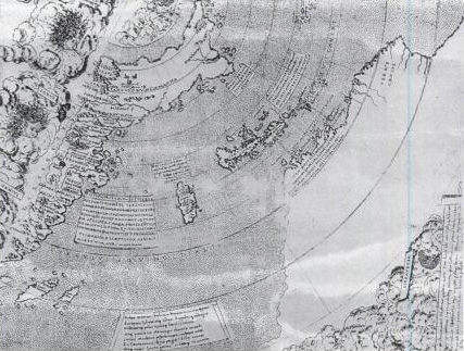
Johann Ruysch world map (1507-1508)
- Date
- 1507–2006
- Mapmaker / publisher
- File author unknown
- Archive
- Wikimedia Commons
- Type
- map
- Original size
- 4,312 × 3,216 pixels
Public domain
Reason: its maker died long enough ago that the copyright has expired.
This status rests on the map's publication history, as researched by Wikimedia Commons. Check it before commercial use.
Read from: Commons licence category: PD Old; no CC BY, CC BY-SA, GFDL or deletion tag on the file page; permission field: none; reproduction of a public domain work due to age.
Credit line
"Ruysch map" (1507–2006). File author unknown, via Wikimedia Commons. Public domain. https://commons.wikimedia.org/wiki/File:Ruysch_map.jpgNeed maps for a whole project? Add Find Any Map to Claude and ask for this one by its id: 104085.
More like this

Caverio map
1505–2006 · Wikimedia Commons

Ruysch map, Gruenlant-Antilia
1507 · Wikimedia Commons

Pedro Reinel map
1504–1937 · Wikimedia Commons

Durer Stabiussche Weltkarte World Map 1515
December 31, 1515 · Wikimedia Commons

The Yale world map of "Henricus Martellus Germanus" (Heinrich Hammer), probably from Florence 1490-92. It is the most detailed "Dragon Tail" map by Martellus. It is the only one with a coordinate grid
1490 · Wikimedia Commons

Apian World map, a greatly reduced version of the Waldseemüller world map of 1507. Caption at top reads: Tipus orbis universalis iuxta Ptolomei cosmographi traditionem et Americi Vespucii aliorumque l
1520 · Wikimedia Commons
Contarini map western detail
1506–2006 · Wikimedia Commons

Apian world map ioanniscamertism00soli 0013
1520 · Wikimedia Commons