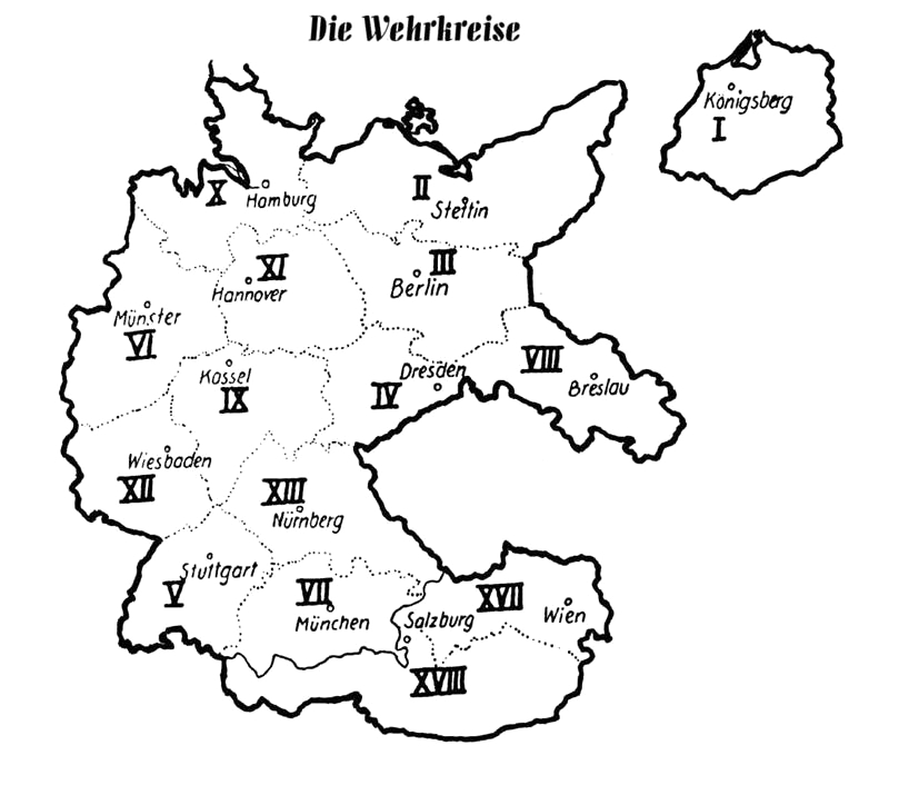

Wehrkreise Deutsches Reich
Wehrkreise des Deutschen Reiches 1939
- Date
- 2007
- Mapmaker / publisher
- unbekannt, unknown
- Place
- the Nazi Germany
- Archive
- Wikimedia Commons
- Type
- map
- Original size
- 818 × 724 pixels
Public domain
Reason: public domain: Germany.
This status rests on the map's publication history, as researched by Wikimedia Commons. Check it before commercial use.
Read from: Commons licence category: PD Germany; no CC BY, CC BY-SA, GFDL or deletion tag on the file page.
Credit line
"Wehrkreise Deutsches Reich" (2007). unbekannt, unknown, via Wikimedia Commons. Public domain. https://commons.wikimedia.org/wiki/File:Wehrkreise_Deutsches_Reich.jpgNeed maps for a whole project? Add Find Any Map to Claude and ask for this one by its id: 24880.
More like this

Map from "The Handbook on German Military Forces (TM-E 30-451)" a publication of the War departement, Military Intelligence Division, March 1945.
1945 · Wikimedia Commons

Deutsche Korpsbereiche 1914
1914 · Wikimedia Commons

SHEAF Handbook SA of the NSDAP 0366 Nazi Germany map Sturmabteilung SA GROUPS WEHRKREIS HQ Number (Uniform plate NSDAP Organisationsbuch 0000) Uncredited artwork Public domain (merged image composite)
1945 · Wikimedia Commons

Germany (Borders 1937)
October 21, 2008 · Wikimedia Commons

Deutschesreich1939
1938 · Wikimedia Commons

German Map Sudeten
October 29, 1938 · Wikimedia Commons

Selbstschutz Westpreussen map
1939 · Wikimedia Commons

Deployment of the Wehrmacht the 1st September 1939.
1939 · Wikimedia Commons