

USGS 1986 Bauxite SEA
Distribution of Bauxite resources in Indonesia, Malaysia and the Phillippines according to the USGS in 1986
- Date
- 1986
- Mapmaker / publisher
- United States Geological Survey
- Place
- the Malay Archipelago
- Archive
- Wikimedia Commons
- Type
- map
- Original size
- 411 × 379 pixels
Public domain
Reason: public domain: USGS.
This status rests on the map's publication history, as researched by Wikimedia Commons. Check it before commercial use.
Read from: Commons licence category: PD USGS; no CC BY, CC BY-SA, GFDL or deletion tag on the file page.
Credit line
"USGS 1986 Bauxite SEA" (1986). United States Geological Survey, via Wikimedia Commons. Public domain. https://commons.wikimedia.org/wiki/File:USGS_1986_Bauxite_SEA.jpgNeed maps for a whole project? Add Find Any Map to Claude and ask for this one by its id: 242712.
More like this

Southern Operations December 1941-May 1942
1994 · Wikimedia Commons
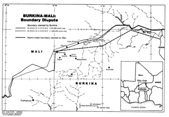
Burkina-Mali boundary dispute, US Department of State map
May 27, 1986 · Wikimedia Commons

(1987) Iron ore. Location map, West Africa deposits
1987 · Wikimedia Commons

Map of eastern Indonesia, 1683
1683 · Wikimedia Commons

Chinese South Sea
Wikimedia Commons

Océan Pacifique et ses principaux archipels - Océanie
1943 · Indonesia

Map of eastern Indonesia, 1719
1683 · Wikimedia Commons

Indo Malay border2
March 15, 1965 · Library of Congress