

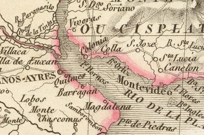
United Provinces orthographic
Exact map of the United Provinces of the Río de la Plata around the year 1825
- Date
- August 30, 2025
- Mapmaker / publisher
- ULIFOX 3XX
- Place
- Argentina
- Archive
- Wikimedia Commons
- Type
- map
- Original size
- 551 × 551 pixels
CC0safest
Reason: CC0: dedicated to the public domain.
Read from: Commons licence category: CC-Zero; no CC BY, CC BY-SA, GFDL or deletion tag on the file page.
Credit line
"United Provinces orthographic" (August 30, 2025). ULIFOX 3XX, via Wikimedia Commons. CC0. https://commons.wikimedia.org/wiki/File:United_Provinces_orthographic_(1825).pngNeed maps for a whole project? Add Find Any Map to Claude and ask for this one by its id: 306195.
More like this

(1828) PLATE OF THE PROVINCES OF BUENOS AYRES, BANDA ORIENTAL & ENTRE RIOS
1828 · Wikimedia Commons

Mapa topografico del Río de la Plata siglo XIX
Wikimedia Commons

Partial view of the Latzina map of 1882. The first official argentine map, produced, after the Boundary Treaty of 1881. It was ordered to be drawn up by the then Argentine Minister of the Interior, Be
1882 · Wikimedia Commons

Map of the basin of La Plata - based upon the results of the expedition under the command of Thos. J. Page, U.S. Navy, in the years 1853,-'54,-'55, & 56 and of the adjacent countries
1856 · Library of Congress
Lapie-1828-RdP1
1828–1833 · Wikimedia Commons

Map of part of South America
1633–1685 · Wikimedia Commons

Map from the Argentine Government Information Office in the capital of Great Britain. That office was a branch of the Agentine Ministry for Foreign Affairs and Workship. The maps shows the internation
1888 · Wikimedia Commons

Also shows province boundaries. "Base 801780 (R00880) 7-96." Relief shown by shading.
1996 · Library of Congress