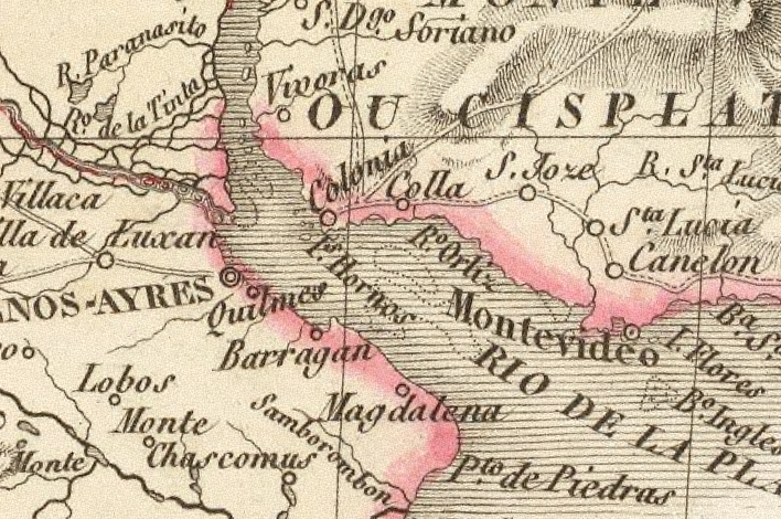

Lapie-1828-RdP1
- Date
- 1828–1833
- Mapmaker / publisher
- Pierre y Alexandre Emile Lapie
- Place
- Argentina
- Archive
- Wikimedia Commons
- Type
- map
- Original size
- 708 × 470 pixels
Public domain
Reason: its maker died long enough ago that the copyright has expired.
This status rests on the map's publication history, as researched by Wikimedia Commons. Check it before commercial use.
Read from: Commons licence category: PD Old; no CC BY, CC BY-SA, GFDL or deletion tag on the file page.
Credit line
"Lapie-1828-RdP1" (1828–1833). Pierre y Alexandre Emile Lapie, via Wikimedia Commons. Public domain. https://commons.wikimedia.org/wiki/File:Lapie-1828-RdP1.jpgNeed maps for a whole project? Add Find Any Map to Claude and ask for this one by its id: 307279.
More like this

(1828) PLATE OF THE PROVINCES OF BUENOS AYRES, BANDA ORIENTAL & ENTRE RIOS
1828 · Wikimedia Commons

Carte de la rivière de la Plata depuis son embouchure jusqu'à Buenos-Ayres d'après les plans levés en 1789 et 1794 par plusieurs Officiers de la Marine d'Espagne. Publiée par ordre du Ministre de la Marine au Dépôt général de la Marine et des Colonies / Gravé par E. Collin
1800–1801 · Wikimedia Commons

Lapie1833-Malvinas
1833 · Wikimedia Commons

Mapa topografico del Río de la Plata siglo XIX
Wikimedia Commons

Map of the basin of La Plata - based upon the results of the expedition under the command of Thos. J. Page, U.S. Navy, in the years 1853,-'54,-'55, & 56 and of the adjacent countries
1856 · Library of Congress

Map of part of South America
1633–1685 · Wikimedia Commons

United Provinces orthographic
August 30, 2025 · Wikimedia Commons

La Plata 1812
January 25, 1812 · Wikimedia Commons