

Ukr Volhyn 1943-1944 var2b
Volhynia and the General Governorate of occupied Polish Territories; Soviet advance (1943 to Aug-1944). OUN(m) partisans. According to the Encyclopedia of Ukraine, Volhynia's borders have shifted considerably westwards over the centuries such that the region is today located entirely within modern Ukraine. 'Ethnographic Volhynia' as it appears here is drawn according to Volodymyr Kubijovyč's nationalities maps in Atlas of Ukrainian and Adjacent Lands (1937) pp.10-11; p.58 PDF, and is therefore party to the OUN's territorial claims rooted in ethnography. This should not be taken as a rigorously researched work but merely a rough illustration of OUN territorial claims that stretch beyond modern convention.
- Date
- July 12, 2025
- Mapmaker / publisher
- Joko2468
- Archive
- Wikimedia Commons
- Type
- map
- Original size
- 1,528 × 1,175 pixels
CC0safest
Reason: CC0: dedicated to the public domain.
Read from: Commons licence category: CC-Zero; no CC BY, CC BY-SA, GFDL or deletion tag on the file page.
Credit line
"Ukr Volhyn 1943-1944 var2b" (July 12, 2025). Joko2468, via Wikimedia Commons. CC0. https://commons.wikimedia.org/wiki/File:Ukr_Volhyn_1943-1944_var2b.pngNeed maps for a whole project? Add Find Any Map to Claude and ask for this one by its id: 23960.
More like this

Poland in 1939
July 24, 1944 · Wikimedia Commons
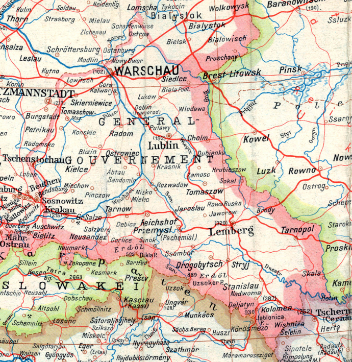
A part of a map of Europe printed by the O.K.H. in 1943.
1944 · Wikimedia Commons

Ukr 1941-1942 annotations colours dnieper borders(var.2a)
July 12, 2025 · Wikimedia Commons

Dialektologicheskaia Karta 1914 goda
1914 · Wikimedia Commons

Axis occupation of Yugoslavia, 1943-44
June 24, 2011 · Wikimedia Commons

Karelo-Finnish SSR, 1941-1944
December 7, 2017 · Wikimedia Commons

Ww2 map22 May7 July 1942
1942 · Wikimedia Commons

Fascist genocide in yugoslavia
Wikimedia Commons