

Karelo-Finnish SSR, 1941-1944
Occupied territory of the Karelo-Finnish SSR in 1941-1944
- Date
- December 7, 2017
- Mapmaker / publisher
- Outline_Map_of_Karelia.svg: Виктор В *derivative work: Semenov.m7
- Place
- Continuation War
- Archive
- Wikimedia Commons
- Type
- map
- Original size
- 400 × 600 pixels
Public domain
Reason: public domain: self.
This status rests on the map's publication history, as researched by Wikimedia Commons. Check it before commercial use.
Read from: Commons licence category: PD-self; no CC BY, CC BY-SA, GFDL or deletion tag on the file page.
Credit line
"Karelo-Finnish SSR, 1941-1944" (December 7, 2017). Outline_Map_of_Karelia.svg: Виктор В *derivative work: Semenov.m7, via Wikimedia Commons. Public domain. https://commons.wikimedia.org/wiki/File:Karelo-Finnish_SSR,_1941-1944.pngNeed maps for a whole project? Add Find Any Map to Claude and ask for this one by its id: 23473.
More like this
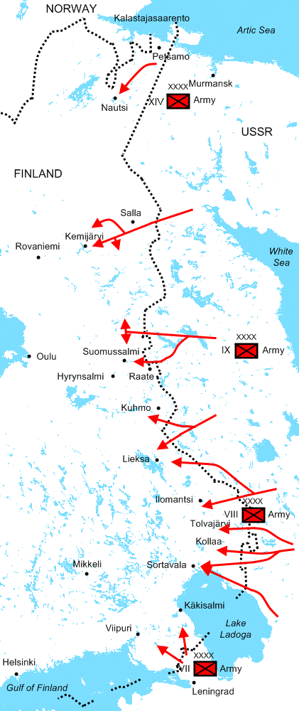
The Soviet major offensives of 30 November - 22 December 1939 in the Winter War.
July 6, 2009 · Wikimedia Commons
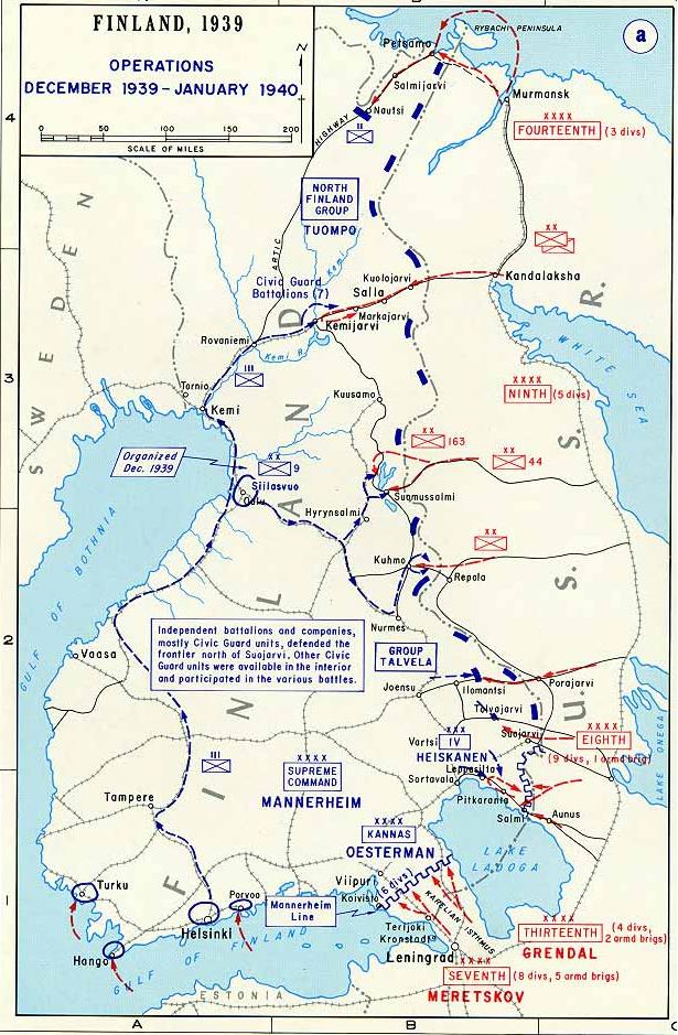
Map of the first phase of the Winter War 1939-40.
1939 · Wikimedia Commons
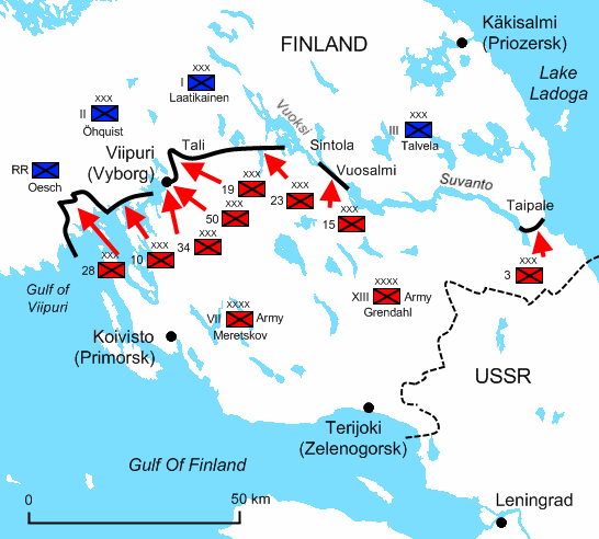
Karelian Isthmus 13 March 1940
September 13, 2009 · Wikimedia Commons

Winter War Soviet attacks December 1939 russian
September 20, 2009 · Wikimedia Commons

Ladogakarelia-winterwar-dec-1939 finnish
July 17, 2009 · Wikimedia Commons

Karelian Isthmus 13 March 1940 russian
September 20, 2009 · Wikimedia Commons

Karelian Isthmus 13 March 1940 finnish
September 20, 2009 · Wikimedia Commons

Karelian Ishtmus December 1939 russian
September 20, 2009 · Wikimedia Commons