

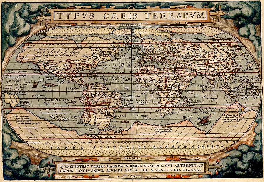
Typvs orbis terrarvm.
Oval map within illustrated border, showing clouds. Includes illustrations. Appears to be an etched, probably unauthorized copy of an edition Ortelius's map, possibly made in Italy. This map copies the re-engraved clouds in lower left corner, which, according to Shirley, dates the map to 1579 or later. The word "occidens" on the left edge of the map reads bottom to top rather than top to bottom as in the original. On laid paper with a watermark of a bunch of grapes. Left margin also cut away in lower corner.
- Date
- 1579
- Mapmaker / publisher
- Ortelius, Abraham
- Archive
- Library of Congress (via Wikimedia Commons)
- Type
- map
- Original size
- 6,330 × 4,688 pixels
Public domainsafest
Reason: its maker died more than 100 years ago.
Read from: Commons licence category: PD-old-100-expired; no CC BY, CC BY-SA, GFDL or deletion tag on the file page.
Credit line
"Typvs orbis terrarvm." (1579). Ortelius, Abraham. Library of Congress, Geography and Map Division, via Wikimedia Commons. Public domain. https://commons.wikimedia.org/wiki/File:Typvs_orbis_terrarvm._LOC_2017585796.jpgNeed maps for a whole project? Add Find Any Map to Claude and ask for this one by its id: 120555.
More like this

Typvs orbis terrarvm
1579 · Library of Congress

Typvs orbis terrarvm
1584 · Library of Congress
Typus orbis terrarum (NYPL Hades-118530-54654)
1587 · New York Public Library

Typvs orbis terrarvm
1628 · Library of Congress

Typus Orbis Terrarum (Image of the globe of the world) RMG F9905
1573 · Wikimedia Commons

Typus orbis terrarum.; Lawrence H. Slaughter Collection of English maps, charts, globes, books and atlases / Atlases / Abraham Ortelius his epitome of the theater of the worlde. Nowe latlye. renewed a
1603 · New York Public Library
Typus Orbis Terrarum drawn by Abraham Ortelius
1598 · Wikimedia Commons

1570 Typus Ortelius mr
1570 · Wikimedia Commons