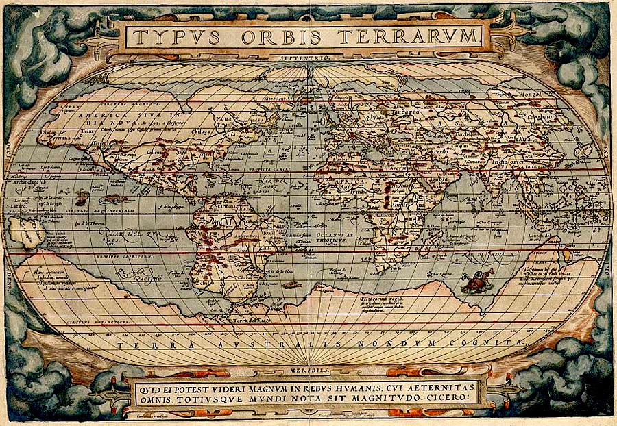

Typus Orbis Terrarum drawn by Abraham Ortelius
Typus Orbis Terrarum, include the Terra Australis Drawn by the cartographer Abraham Ortelius(1527-1598) around 1570.
- Date
- 1598
- Mapmaker / publisher
- Original uploader was Fuelbottle at en.wikipedia
- Archive
- Wikimedia Commons
- Type
- map
- Original size
- 900 × 622 pixels
Public domain
Reason: its maker died more than 100 years ago.
This status rests on the map's publication history, as researched by Wikimedia Commons. Check it before commercial use.
Read from: Commons licence category: PD-old-100; no CC BY, CC BY-SA, GFDL or deletion tag on the file page; permission field: PD-ART..
Credit line
"Typus Orbis Terrarum drawn by Abraham Ortelius" (1598). Original uploader was Fuelbottle at en.wikipedia, via Wikimedia Commons. Public domain. https://commons.wikimedia.org/wiki/File:Typus_Orbis_Terrarum_drawn_by_Abraham_Ortelius.jpgNeed maps for a whole project? Add Find Any Map to Claude and ask for this one by its id: 145898.
More like this

Carte Ortelius 1570
1570 · Wikimedia Commons
Typus orbis terrarum (NYPL Hades-118530-54654)
1587 · New York Public Library

1570 Typus Ortelius mr
1570 · Wikimedia Commons

Typus Orbis Terrarum (Image of the globe of the world) RMG F9905
1573 · Wikimedia Commons

Typvs orbis terrarvm
1584 · Library of Congress

Typus orbis terrarum.; Lawrence H. Slaughter Collection of English maps, charts, globes, books and atlases / Atlases / Abraham Ortelius his epitome of the theater of the worlde. Nowe latlye. renewed a
1603 · New York Public Library

Typus orbis terrarum. Ab. Ortelius describ. cum privilegio decennali 1587. (in upper margin:) Mappemonde d'Ortelius, 1587. Fac-simile heliographique. Photogravure Dujardin. Imp. Fraillery. Histoire de la geographie. Atlas pl. XI. Librairie Hachette et Cie. (1874)
1587 · Wikimedia Commons

Typvs orbis terrarvm / Ab. Ortelius describ. cum privilegio decennali. 1587
1587 · Wikimedia Commons