

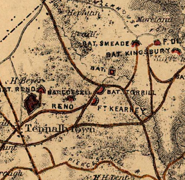
The line between the River Road and Broad Branch, showing Fort Reno, Battery Reno, Battery Rossell, Fort Kearny and Battery Terrill
- Date
- 1818–1941
- Place
- the Civil War Defenses of Washington, D.C.
- Archive
- U.S. National Archives (via Wikimedia Commons)
- Type
- map
- Original size
- 22,722 × 8,352 pixels
Public domain
Reason: a US government work.
This status rests on the map's publication history, as researched by Wikimedia Commons. Check it before commercial use.
Read from: Commons licence category: PD US Government; no CC BY, CC BY-SA, GFDL or deletion tag on the file page; Commons tags it as a US government work, but its record names no government maker.
Credit line
"The line between the River Road and Broad Branch, showing Fort Reno, Battery Reno, Battery Rossell, Fort Kearny and Battery Terrill" (1818–1941). U.S. National Archives, via Wikimedia Commons. Public domain. https://commons.wikimedia.org/wiki/File:The_line_between_the_River_Road_and_Broad_Branch,_showing_Fort_Reno,_Battery_Reno,_Battery_Rossell,_Fort_Kearny_and_Battery_Terrill_-_NARA_-_122207802.jpgNeed maps for a whole project? Add Find Any Map to Claude and ask for this one by its id: 332.
More like this
Ft. Kearny Crop
1865 · Wikimedia Commons

Plans of fortifications between Fort Reno and Battery Reno
1866 · 2 sheets

The Line between Powder Mill Branch and the River Road, showing Battery Bailey, Battery Mansfield, Fort Mansfield, Battery Simmons, Fort Simmons, and Fort Bayard
1818–1941 · U.S. National Archives

The Line Between Fort Slocum & Bladenburg Road
1818–1941 · U.S. National Archives

Bomb-Proof Guard-House for Fort Reno
1818–1941 · U.S. National Archives

The Line Between Bladensburg Road & Fort Slemmer
1818–1941 · U.S. National Archives

Fort Reno, Washington, D.C.,1892
1892 · Wikimedia Commons

Plan of Fort Sumner, Montgomery County, composed of Redoubts Cross, Davis, and Kirby and also showing nearby rifle pits and Batteries Alexander and Benson, part of the defenses of Washington, D. C.
1861–1865 · U.S. National Archives