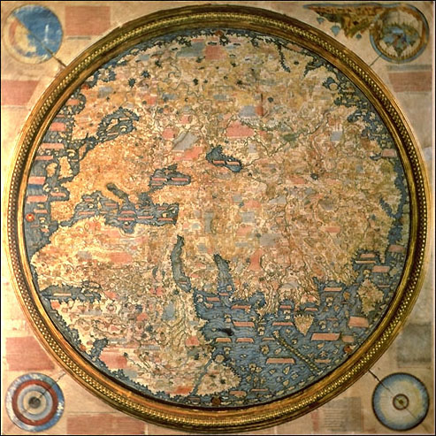

The Fra Mauro map. 1459.
- Date
- 1459
- Mapmaker / publisher
- Originally uploaded to English Wikipedia by PHG
- Archive
- Wikimedia Commons
- Type
- map
- Original size
- 493 × 493 pixels
Public domainsafest
Reason: its maker died more than 70 years ago, and a faithful scan of a flat work adds no new copyright.
Read from: Commons licence category: PD-Art (PD-old-70); no CC BY, CC BY-SA, GFDL or deletion tag on the file page.
Credit line
"The Fra Mauro map. 1459." (1459). Originally uploaded to English Wikipedia by PHG, via Wikimedia Commons. Public domain. https://commons.wikimedia.org/wiki/File:FraMauroMap.jpgNeed maps for a whole project? Add Find Any Map to Claude and ask for this one by its id: 145138.
More like this

Fra Mauro Map
1459 · Wikimedia Commons

Fra Mauro map (1460)
1460 · Wikimedia Commons

(Venice) Fra'Mauro's World Map - Biblioteca Nazionale Marciana
1457–1459 · Wikimedia Commons

The Yale world map of "Henricus Martellus Germanus" (Heinrich Hammer), probably from Florence 1490-92. It is the most detailed "Dragon Tail" map by Martellus. It is the only one with a coordinate grid
1490 · Wikimedia Commons

The world map from a 1474 Florentine Latin edition of Maximus Planudes's late-13th century rediscovered Greek manuscripts of Ptolemy's 2nd-century Geography.
1474 · Wikimedia Commons

Facsimile of a Genoese world map published in 1457
1457 · Wikimedia Commons

Habitabilis Nostre Tabula
1490 · Wikimedia Commons

Apographon descriptionis orbis terrae. circa medium Saec. XV tabulae aeneae Musei Borgiani Velitris consignatoe quod Camillus. Borgia,. summa fide, maximo que artificio expressum. eruditis spectandum proponit A. C. 1797
1450 · Wikimedia Commons