

Fra Mauro Map
1459 map of the world by Venetian cartographer Fra Mauro.
- Date
- 1459
- Mapmaker / publisher
- Fra Mauro
- Archive
- Wikimedia Commons
- Type
- map
- Original size
- 77,056 × 63,684 pixels
Public domainsafest
Reason: its US copyright has expired (published before 1931).
Read from: Commons licence category: PD US expired; no CC BY, CC BY-SA, GFDL or deletion tag on the file page.
Credit line
"Fra Mauro Map" (1459). Fra Mauro, via Wikimedia Commons. Public domain. https://commons.wikimedia.org/wiki/File:Fra_Mauro_Map.pngNeed maps for a whole project? Add Find Any Map to Claude and ask for this one by its id: 145146.
More like this
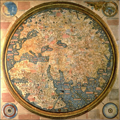
The Fra Mauro map. 1459.
1459 · Wikimedia Commons

Fra Mauro map (1460)
1460 · Wikimedia Commons

The Carlo Naya Facsimile of the Fra Mauro Mappa Mundi
1450–1873 · Wikimedia Commons

(Venice) Fra'Mauro's World Map - Biblioteca Nazionale Marciana
1457–1459 · Wikimedia Commons

The Yale world map of "Henricus Martellus Germanus" (Heinrich Hammer), probably from Florence 1490-92. It is the most detailed "Dragon Tail" map by Martellus. It is the only one with a coordinate grid
1490 · Wikimedia Commons

FraMauroMapSpainPortugalNorthenAfrica
Wikimedia Commons

FraMauroDetailedMapInverted
Wikimedia Commons

Anonymous map of the world, 1450-1470
1450 · Wikimedia Commons