

Taprobana Insul
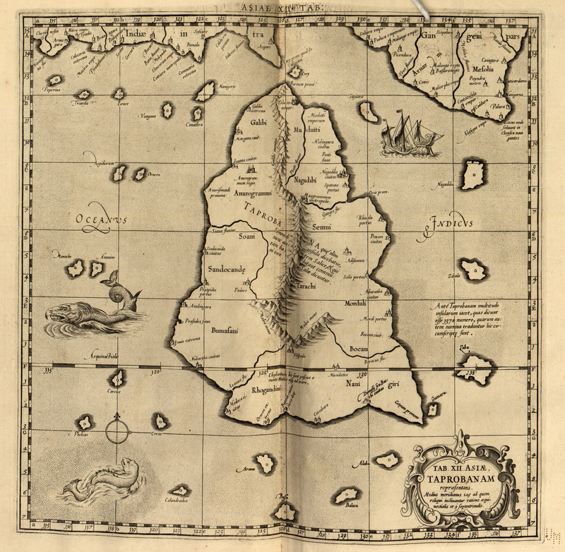
The 12th Asian Map, depicting Taprobana Island. Ascribed to the nonexistant "1492" Ptolemy, intending the 1482 Ulm edition by Leonard Hol.
- Date
- 1482
- Mapmaker / publisher
- Ptolemy; Paul Lacroix
- Place
- Sri Lanka
- Archive
- Wikimedia Commons
- Type
- map
- Original size
- 723 × 759 pixels
Public domainsafest
Reason: its maker died more than 70 years ago.
Read from: Commons licence category: PD-old-70-expired; no CC BY, CC BY-SA, GFDL or deletion tag on the file page.
Credit line
"Taprobana Insul" (1482). Ptolemy; Paul Lacroix, via Wikimedia Commons. Public domain. https://commons.wikimedia.org/wiki/File:Taprobana_Insul.jpgNeed maps for a whole project? Add Find Any Map to Claude and ask for this one by its id: 239644.
More like this

Duodecima et Ultima Asiae Tabula
1478 · Wikimedia Commons
Tab. XII. Asiae. Taprobanam
1730 · Wikimedia Commons

A collection of maps, in Greek, after Ptolemy's Geographia
1420 · Asia

Taprobane Nesos
Wikimedia Commons

1528 - Bordone - BNF - Taprobana
1528 · Wikimedia Commons

Tabula Asiae XII, Taprobana insula
1550 · Wikimedia Commons

Decima Asiae Tabula.
1490 · Wikimedia Commons

1490 Ptolemaic world map
1490 · Wikimedia Commons