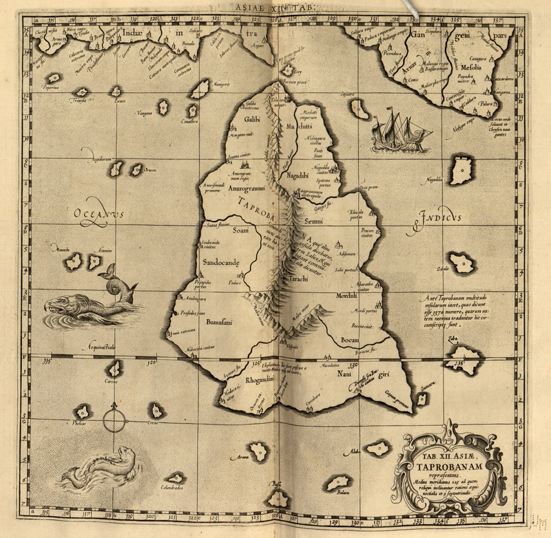

Tab. XII. Asiae. Taprobanam
The 12th Map of Asia (Tab. XII. Asiae), depicting Sri Lanka (Taprobana), from a reprint of Gerard Mercator's edition of Ptolemy's Geography.
- Date
- 1730
- Mapmaker / publisher
- Ptolemy
- Place
- Sri Lanka
- Archive
- Wikimedia Commons
- Type
- map
- Original size
- 800 × 782 pixels
Public domainsafest
Reason: its maker died more than 70 years ago.
Read from: Commons licence category: PD-old-70-expired; no CC BY, CC BY-SA, GFDL or deletion tag on the file page.
Credit line
"Tab. XII. Asiae. Taprobanam" (1730). Ptolemy, via Wikimedia Commons. Public domain. https://commons.wikimedia.org/wiki/File:Tab._XII._Asiae._Taprobanam.jpgNeed maps for a whole project? Add Find Any Map to Claude and ask for this one by its id: 241143.
More like this

Duodecima et Ultima Asiae Tabula
1478 · Wikimedia Commons

Decima Asiae Tabula.
1490 · Wikimedia Commons

Tabula Asiae XII, Taprobana insula
1550 · Wikimedia Commons

The Cosmography of Claudius Ptolemaeus the Alexandrian (Cosmographia Claudii Ptolomaei Alexandrini)
1467 · Sri Lanka

Duodecima Asiae tabula
1511 · Wikimedia Commons

Mercator's Orbis Antiqui Tabulae Geographicae Secundum Cl. Ptolemaeum (1730) 22
1730 · Sri Lanka

Ptolemaic map of India and Southeast Asia from Martin Waldseemüller's 1513 edition of Ptolemy's Geographia.
1513 · Wikimedia Commons

Insula Zeilan olim Taprobana nunc incolis Tenarisim
1601–1700 · Wikimedia Commons