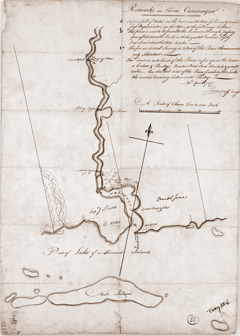

Surveryor's map of Gananoque 1787
Surveryor's map of the Gananoque, Ontario region, showing private allotments and "Indian burial places".
- Date
- 1787
- Mapmaker / publisher
- Patrick McNiff, government surveyor for Upper Canada
- Place
- Ontario
- Archive
- Wikimedia Commons
- Type
- map
- Original size
- 484 × 677 pixels
Public domainsafest
Reason: its maker died more than 100 years ago, and a faithful scan of a flat work adds no new copyright.
Read from: Commons licence category: PD-Art (PD-old-100); no CC BY, CC BY-SA, GFDL or deletion tag on the file page; permission field: PD.
Credit line
"Surveryor's map of Gananoque 1787" (1787). Patrick McNiff, government surveyor for Upper Canada, via Wikimedia Commons. Public domain. https://commons.wikimedia.org/wiki/File:Surveryor%27s_map_of_Gananoque_1787.pngNeed maps for a whole project? Add Find Any Map to Claude and ask for this one by its id: 295676.
More like this

Mouth of the Niagara River, 1798
1798 · Wikimedia Commons

Plan of Dundas Street from Burlington Bay to the River Trent
1795 · Wikimedia Commons

Bay of Quinte, Kingston, mouth of Lake Ontario, from William Chewitt's 1821 map of Upper Canada
1821 · Wikimedia Commons

Sketch Map of Upper Canada showing the routes Lt Gov Simcoe took on journeys between March 1793 and September 1795
1795 · Wikimedia Commons

Map of Fort Chippewa, Upper Canada, 1798
1798 · Wikimedia Commons

Genticore plate, Upper Canada
1790–1799 · Wikimedia Commons

Eastern lake ontario, published in 1813
1813 · Wikimedia Commons

Tribal nations in NW New York Province
1771 · Wikimedia Commons