

Stockholm 1560s copperplate Frantz Hogenberg
Copperplate of Stockholm in the 1560s by Frantz Hogenberg.
- Mapmaker / publisher
- Mats Halldin 12:01, 3 May 2007 (UTC)
- Place
- Stockholm by Braun & Hogenberg
- Archive
- Wikimedia Commons
- Type
- map
- Original size
- 1,953 × 1,089 pixels
Public domain
Reason: its maker died more than 100 years ago, and a faithful scan of a flat work adds no new copyright.
This status rests on the map's publication history, as researched by Wikimedia Commons. Check it before commercial use.
Read from: Commons licence category: PD-Art (PD-old-100); no CC BY, CC BY-SA, GFDL or deletion tag on the file page; permission field: PD-Art.
Credit line
"Stockholm 1560s copperplate Frantz Hogenberg". Mats Halldin 12:01, 3 May 2007 (UTC), via Wikimedia Commons. Public domain. https://commons.wikimedia.org/wiki/File:Stockholm_1560s_copperplate_Frantz_Hogenberg.JPGNeed maps for a whole project? Add Find Any Map to Claude and ask for this one by its id: 303453.
More like this

Stockholm viewed from north. Copperplate by Frans Hogenberg c. 1570.
c. 1570 · Wikimedia Commons

Slussen Hogenberg 1560s
Wikimedia Commons

Stockholm viewed from south. Copperplate by Frans Hogenberg after a drawing by Hieronymus Scholeus c. 1570.
c. 1570 · Wikimedia Commons
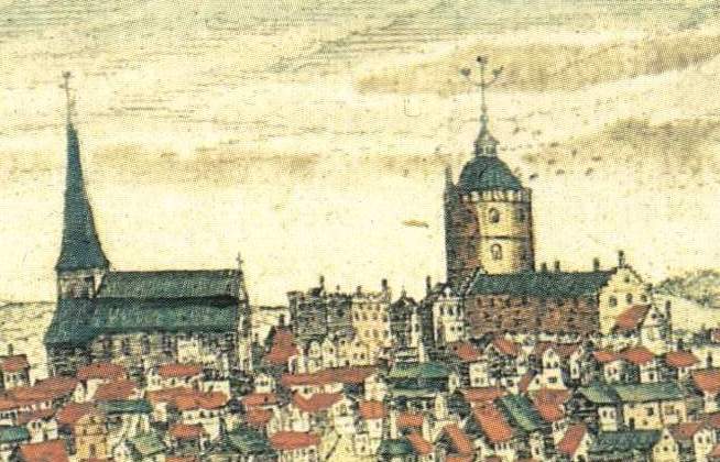
Storkyrkan Tre kronor Hogenberg 1560s
Wikimedia Commons

Stockholm-1570 Braun-Hogenberg Civitates-orbis-terrarum
c. 1570 · Wikimedia Commons

Våghuset 1560-tal, Frantz Hogenberg
1560 · Wikimedia Commons

Liber qvartvs Vrbivm praecipvarvm totivs Mvndi
Wikimedia Commons

Alten Stettin Hogenberg
1581–2016 · Wikimedia Commons