

Sketch map showing the general course of the newly discovered tributary of the Madeira and the approximate route of the Roosevelt-Rondon expedition.
"The inset shows the location and extent of the main map." From Bulletin of the American Geographical Society, July, 1914.
- Date
- 1914
- Place
- Brazil
- Archive
- Library of Congress (via Wikimedia Commons)
- Type
- map
- Original size
- 1,670 × 2,560 pixels
Public domainsafest
Reason: its maker died more than 100 years ago.
Read from: Commons licence category: PD-old-100-expired; no CC BY, CC BY-SA, GFDL or deletion tag on the file page.
Credit line
"Sketch map showing the general course of the newly discovered tributary of the Madeira and the approximate route of the Roosevelt-Rondon expedition." (1914). Library of Congress, Geography and Map Division, via Wikimedia Commons. Public domain. https://commons.wikimedia.org/wiki/File:Sketch_map_showing_the_general_course_of_the_newly_discovered_tributary_of_the_Madeira_and_the_approximate_route_of_the_Roosevelt-Rondon_expedition._LOC_2006629765.jpgNeed maps for a whole project? Add Find Any Map to Claude and ask for this one by its id: 118448.
More like this

Central Brazil and the new Rio Theodoro.
1915 · Library of Congress

Esboço geographico organizado em conformidade de documentos officiaes e outros valiosos com o fim principal de mostrar a fronteira do Brazil, no territorio comprehendido entre os Rios Madeira e Javary
1874 · Library of Congress

N548 w1150
1908 · Wikimedia Commons

Distribution areas for bow and arrow types in central Brazil.
1896 · Library of Congress

Sketch map of part of Tibet showing the explorations and journeys of Dr. Sven Hedin, 1906-1908.
1906 · Library of Congress

Brazil and Bolivia boundary.
1915 · Library of Congress
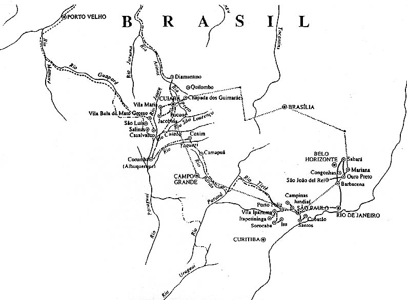
Chart of the Langsdorff Expedition (1826-1829) in Brazil, by Baron von Langsdorff, a German physician and naturalist, for the Russian Imperial Academy of Sciences. Public domain image adapted from ori
1826–1829 · Wikimedia Commons

Maps of the Border Region Between the States of Rio of Janeiro, Minas Gerais and São Paulo, and of the Course of the São Francisco River
1700–1799 · Wikimedia Commons