

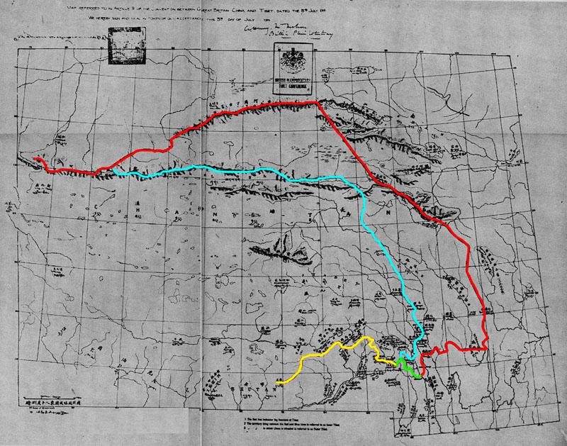
Simla Convention - contending claims in Kham
The contending claims of China-Tibet boundary made at the 1914 Simla Conference. From the map legend:; Dark red line: Frontier of Tibet proposed in the Simla Convention.; Dark brown line: Frontier of Tibet proposed by China.; Dark blue line: Boundary between Outer and Inner Tibet proposed in the Simla Convention.; Light blue line: Frontier claimed by China in 1914.; Pink line: Chinese proposal in 1915 for the boundary between Outer and Inner Tibet.; Dashed blue line: Chinese proposal in 1919 for the boundary between Outer and Inner Tibet.
- Date
- 1945
- Mapmaker / publisher
- Hugh Richardson
- Place
- Kham
- Archive
- Wikimedia Commons
- Type
- map
- Original size
- 1,725 × 1,397 pixels
Public domain
Reason: public domain: India.
This status rests on the map's publication history, as researched by Wikimedia Commons. Check it before commercial use.
Read from: Commons licence category: PD India; no CC BY, CC BY-SA, GFDL or deletion tag on the file page.
Credit line
"Simla Convention - contending claims in Kham" (1945). Hugh Richardson, via Wikimedia Commons. Public domain. https://commons.wikimedia.org/wiki/File:Simla_Convention_-_contending_claims_in_Kham.jpgNeed maps for a whole project? Add Find Any Map to Claude and ask for this one by its id: 256354.
More like this

Frontier Proposals at the Simla Conference
1945 · Wikimedia Commons

Chinese Proposals for a Frontier Settlement 1915-1919
1945 · Wikimedia Commons

Map Referred to in Article 9 of Convention between Great Britain, China and Tibet, dated, the 3rd July 1914 Map No. 1
1945 · Kham

Map Referred to in Article 9 of Convention between Great Britain, China and Tibet, dated, the 3rd July 1914 Map No. 1
1945 · Qinghai

Sketch Map of Central and Eastern Tibet
1945 · Wikimedia Commons

1945 McMahon Area--Map No 5 from Tibetan Precis
1945 · Wikimedia Commons
Simla Accord Treaty 1914 Map1
1914 · Wikimedia Commons

1959 India's Frontier with China by Indian Ministry of External Affairs
1959 · Wikimedia Commons