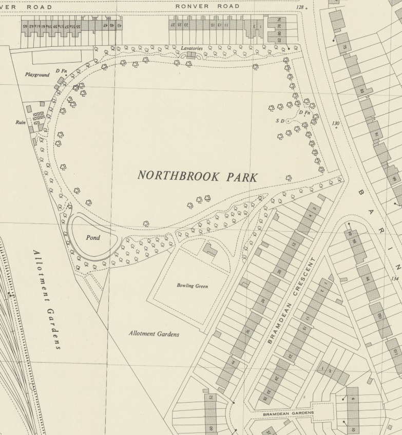

Section of OS map published in 1944 showing in Grove Park
- Date
- March 1, 1944
- Mapmaker / publisher
- Image taken from Crown OS map published in 1944 which is now in public domain
- Place
- London
- Archive
- Wikimedia Commons
- Type
- map
- Original size
- 783 × 847 pixels
Public domain
Reason: its maker died more than 70 years ago, and a faithful scan of a flat work adds no new copyright.
This status rests on the map's publication history, as researched by Wikimedia Commons. Check it before commercial use.
Read from: Commons licence category: PD-Art (PD-old-70); no CC BY, CC BY-SA, GFDL or deletion tag on the file page.
Credit line
"Section of OS map published in 1944 showing in Grove Park" (March 1, 1944). Image taken from Crown OS map published in 1944 which is now in public domain, via Wikimedia Commons. Public domain. https://commons.wikimedia.org/wiki/File:NorthbrookPark1944OSmap.jpgNeed maps for a whole project? Add Find Any Map to Claude and ask for this one by its id: 292031.
More like this

Ordnance Survey Map of Deptford Wharf and surroundings, revised 1914, published 1916.
1916 · Wikimedia Commons

Map of Claigmar Vineyard 1920
1920 · Wikimedia Commons

Hand Coloured Map Descriptive of London Poverty 1898-1899 Sheet 119 - Lewisham, Ladywell, Hither Green and Lee
1894–1899 · Wikimedia Commons

London South East Vol. J: sheet 4-4
1897 · Wikimedia Commons

London South East Vol. J: sheet 30-2
1897 · Wikimedia Commons

Hand Coloured Map Descriptive of London Poverty 1898-1899 Sheet 117 - East Dulwich, Camberwell, Peckham Rye Park
1894–1899 · Wikimedia Commons

London South East Vol. J: sheet 34
1897 · Wikimedia Commons

Hand Coloured Map Descriptive of London Poverty 1898-1899 Sheet 118 - Nunhead Cemetery, Newlands, Honour Oak, (Crofton Park)
1894–1899 · Wikimedia Commons