

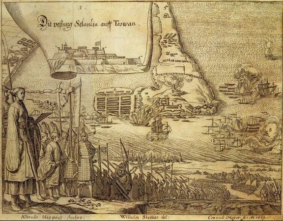
東印度旅行短記鄭荷交戰圖S
- Date
- 1669
- Place
- Taiwan
- Archive
- Wikimedia Commons
- Type
- bird's-eye view
- Original size
- 626 × 600 pixels
Public domain
Reason: its maker died long enough ago that the copyright has expired.
This status rests on the map's publication history, as researched by Wikimedia Commons. Check it before commercial use.
Read from: Commons licence category: PD Old; no CC BY, CC BY-SA, GFDL or deletion tag on the file page.
Credit line
"東印度旅行短記鄭荷交戰圖S" (1669). Wikimedia Commons. Public domain. https://commons.wikimedia.org/wiki/File:%E6%9D%B1%E5%8D%B0%E5%BA%A6%E6%97%85%E8%A1%8C%E7%9F%AD%E8%A8%98%E9%84%AD%E8%8D%B7%E4%BA%A4%E6%88%B0%E5%9C%96S.jpgNeed maps for a whole project? Add Find Any Map to Claude and ask for this one by its id: 138997.
More like this
Surrender of Fort Zeelandia
1669 · Wikimedia Commons

Die Festung Selandia auff Teowan
1669 · Wikimedia Commons

Fort Zealandia Taiwan
1670 · Wikimedia Commons

1644 熱蘭遮城 -- 臺灣城 (Formosa - Fort de Zeelande ou de Taiovang)TAIWAN
1644 · Wikimedia Commons

View of city and Fort Zeelandia on Taiwan
c. 1670 · Wikimedia Commons

Bird's-Eye View of Fort Zeelandia and Warehouses, 1635
1635 · Wikimedia Commons

Bird's-Eye View of Zeelandia, c. 1652
1652 · Wikimedia Commons

Belegering en ontzet van het fort Philippines
1649–1651 · Wikimedia Commons