

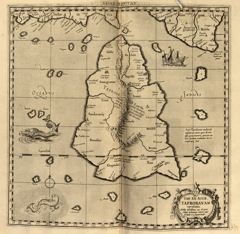
Ruscelli-map-1562 Tamil vanni country
Map of taprobana 'modern day Sri Lanka' by Ptolamy tolamy Copyright expired 1562 map by Ruscelli
- Date
- 1562
- Mapmaker / publisher
- Ruscelli 1562
- Place
- Sri Lanka
- Archive
- Wikimedia Commons
- Type
- map
- Original size
- 1,950 × 1,473 pixels
Public domainsafest
Reason: its maker died more than 70 years ago, and a faithful scan of a flat work adds no new copyright.
Read from: Commons licence category: PD-Art (PD-old-70); no CC BY, CC BY-SA, GFDL or deletion tag on the file page.
Credit line
"Ruscelli-map-1562 Tamil vanni country" (1562). Ruscelli 1562, via Wikimedia Commons. Public domain. https://commons.wikimedia.org/wiki/File:Ruscelli-map-1562_Tamil_vanni_country.jpgNeed maps for a whole project? Add Find Any Map to Claude and ask for this one by its id: 255221.
More like this

Map older than 200 years old of Tamil country Vanni Copyright expired Map of Tamil country by Gerardus Mercator, 1500s, reproduced by Jodocus Hondius, 1607
1607 · Wikimedia Commons

Tabula Asiae XII, Taprobana insula
1550 · Wikimedia Commons

From the "L'Isole Piv Famose Del Mondo," by Porcacchi; a 1572 map from 1620 edition; *title page
1620 · Wikimedia Commons

La Geografia di Claudio Tolomeo Alessandrino, Tradotta di Greco nell'Idioma Volgare Italiano da Girolamo Russcelli (1598) 28
1598 · Sri Lanka
Tab. XII. Asiae. Taprobanam
1730 · Wikimedia Commons

The Cosmography of Claudius Ptolemaeus the Alexandrian (Cosmographia Claudii Ptolomaei Alexandrini)
1467 · Sri Lanka

Decima Asiae Tabula.
1490 · Wikimedia Commons

Calecut Nuova Tavola
1561 · Wikimedia Commons