

RED RIVER CAMPAIGN MAP
- Date
- 1891
- Mapmaker / publisher
- United States, War Department
- Place
- the American Civil War
- Archive
- Wikimedia Commons
- Type
- atlas page
- Original size
- 11,161 × 6,748 pixels
Public domain
Reason: a US government work.
This status rests on the map's publication history, as researched by Wikimedia Commons. Check it before commercial use.
Read from: Commons licence category: PD US; no CC BY, CC BY-SA, GFDL or deletion tag on the file page.
Credit line
"RED RIVER CAMPAIGN MAP" (1891). United States, War Department, via Wikimedia Commons. Public domain. https://commons.wikimedia.org/wiki/File:RED_RIVER_CAMPAIGN_MAP.jpgNeed maps for a whole project? Add Find Any Map to Claude and ask for this one by its id: 146.
More like this

Map Showing the Route of the Army During the Red River Campaign in the Spring of 1864. Surveys & Reconnoissances by Osw. Dietz, Civil Engineers, and Lieuts. Miles & McGregory.
1864 · U.S. National Archives

Red River battles
1895 · Library of Congress
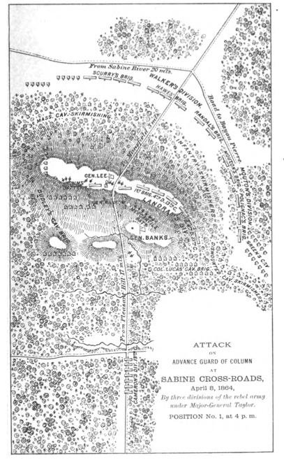
MansfieldMapFromBanksOfficaReport
1891 · Wikimedia Commons

Map of Red River and the Country South and east of Alexandria. Surveyed under the direction of Capt. E. Gottheil, Chief Engineer, Dist. Wesn. La., Head Quarters, Engineer Department, Dist. Western Louisiana.
1861–1865 · U.S. National Archives

Campaign map of Texas, Louisiana and Arkansas, showing all the battle fields and also the marches of Walker's Division. (1861-65)
1876 · Library of Congress

Department of the Gulf Map No. 48. Atchafalaya Basin
1864 · U.S. National Archives