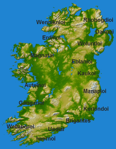

Ptolemy's Ireland
Topography of Ireland with added names.
- Date
- 2005
- Mapmaker / publisher
- NASA
- Archive
- Wikimedia Commons
- Type
- map
- Original size
- 454 × 580 pixels
Public domain
Reason: public domain: NASA.
This status rests on the map's publication history, as researched by Wikimedia Commons. Check it before commercial use.
Read from: Commons licence category: PD NASA; no CC BY, CC BY-SA, GFDL or deletion tag on the file page.
Credit line
"Ptolemy's Ireland" (2005). NASA, via Wikimedia Commons. Public domain. https://commons.wikimedia.org/wiki/File:Ptolemy%27s_Ireland.pngNeed maps for a whole project? Add Find Any Map to Claude and ask for this one by its id: 245858.
More like this

Ireland According to Ptolemy
November 11, 2014 · Wikimedia Commons

Argentine Ptolemy Ireland 1513
1513 · Wikimedia Commons

Карта Птолемея
Wikimedia Commons

A collection of maps, in Greek, after Ptolemy's Geography
1420 · Europe

055 irland
1905 · Wikimedia Commons

A new and correct chart of the coast of IRELAND; Atlases, gazetteers, guidebooks and other books / The sea-atlas: containing an hydrographical description of most of the sea-coasts of the known parts
1702–1707 · New York Public Library

Iouernia kai Alouionos Nesoi
Wikimedia Commons

Tabula I Europae
1535 · Wikimedia Commons