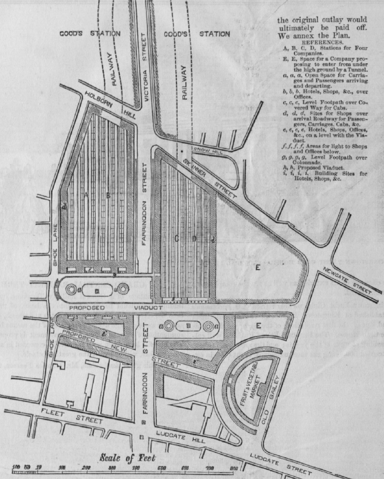

Proposed Central Railway Terminus
Proposal by Charles Pearson (1793-1862) for a central railway terminus for London. The illustration shows the planned layout of the station centred on Farringdon Street between Fleet Street and Holborn Hill, with capacity for four railway companies 'A', 'B', 'C' and 'D' and expansion space for one more, 'E'. The railway lines arrive from the north. Despite much lobbying from Pearson, the station was never constructed.
- Date
- May 23, 1846
- Mapmaker / publisher
- unknown (possibly Charles Pearson himself)
- Place
- London
- Archive
- Wikimedia Commons
- Type
- map
- Original size
- 781 × 975 pixels
Public domain
Reason: public domain: UK.
This status rests on the map's publication history, as researched by Wikimedia Commons. Check it before commercial use.
Read from: Commons licence category: PD-UK; no CC BY, CC BY-SA, GFDL or deletion tag on the file page.
Credit line
"Proposed Central Railway Terminus" (May 23, 1846). unknown (possibly Charles Pearson himself), via Wikimedia Commons. Public domain. https://commons.wikimedia.org/wiki/File:Proposed_Central_Railway_Terminus.pngNeed maps for a whole project? Add Find Any Map to Claude and ask for this one by its id: 291819.
More like this

Plan showing the proposed entrance into Boston of the Fitchburg Rail Road.
1840 · Library of Congress

DISTRICT(1888) p140 - Paddington Station (plan)
1888 · Wikimedia Commons

DISTRICT(1888) p143 - London Bridge station (plan)
1888 · Wikimedia Commons

ONL (1887) 1.496 - Wren's Plan for Rebuilding London
1873–1887 · Wikimedia Commons

(D) WYATT'S PLAN
1877 · Wikimedia Commons

(A) EDWARD OGLES' PLAN
1877 · Wikimedia Commons

Anon 1843
1843 · Wikimedia Commons

The Pleasure Bath, Peerless Pool, City Road
1846 · Wikimedia Commons