

print, map, book-illustration
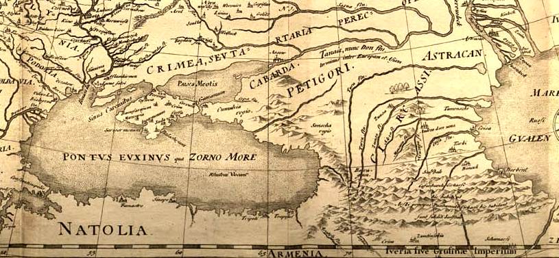
Map of Narzan Valley, between mountains at centre, running towards a plain at right; illustration to an unidentified publication. Engraving
- Place
- the Caucasus
- Archive
- Wikimedia Commons
- Type
- map
- Original size
- 2,500 × 1,463 pixels
Public domain
Reason: its maker died more than 100 years ago.
This status rests on the map's publication history, as researched by Wikimedia Commons. Check it before commercial use.
Read from: Commons licence category: PD-old-100-expired; no CC BY, CC BY-SA, GFDL or deletion tag on the file page; permission field: © The Trustees of the British Museum, released as CC BY-NC-SA 4.0.
Credit line
"print, map, book-illustration". Wikimedia Commons. Public domain. https://commons.wikimedia.org/wiki/File:Print,_map,_book-illustration_(BM_1869,0508.293).jpgNeed maps for a whole project? Add Find Any Map to Claude and ask for this one by its id: 241460.
More like this

Caucasus map
1875 · Wikimedia Commons

Map of the Caucasus showing Circassia.
Wikimedia Commons

Caucasie
Wikimedia Commons

print, book-illustration, map
1544–1552 · BM 1982,U.2464

Plan of Greater or Upper Madshary
1799–1801 · Wikimedia Commons
Fedor chertezh cropped
1614 · Wikimedia Commons

Mt Kazbek & Devdoraki Glaciers (Élisée Reclus)
1891 · Wikimedia Commons

Westlicher Theil des Berner Oberlandes mit dem Brienzer und Thuner See
Wikimedia Commons