

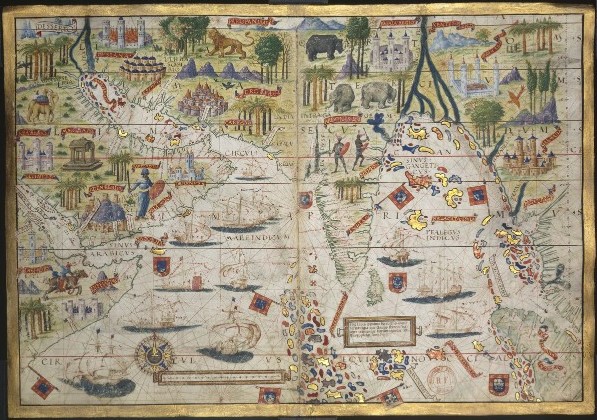
Portulans
- Date
- 1522
- Mapmaker / publisher
- Garcia de Toreno, Nuño (14.-15.?). Auteur du texte
- Place
- the Indian Ocean
- Archive
- Wikimedia Commons
- Type
- map
- Original size
- 4,340 × 6,690 pixels
Public domainsafest
Reason: its US copyright has expired (published before 1931).
Read from: Commons licence category: PD US expired; no CC BY, CC BY-SA, GFDL or deletion tag on the file page.
Credit line
"Portulans" (1522). Garcia de Toreno, Nuño (14.-15.?). Auteur du texte, via Wikimedia Commons. Public domain. https://commons.wikimedia.org/wiki/File:Portulans_-_btv1b8459150g_(1_of_2).jpgNeed maps for a whole project? Add Find Any Map to Claude and ask for this one by its id: 234854.
More like this

Portolan atlas of 9 charts and a world map, etc. Dedicated to Hieronymus Ruffault, Abbot of St. Vaast
1544 · Plate 7

Anonymous chart Valladolid 16 century
Wikimedia Commons
AtlasMiller BNF OceanoIndico
c. 1519 · Wikimedia Commons

Portulans (reprod. photogr.) atlas portugais dit Miller
1516 · Plate 2 of 2

Genoese map Indian Ocean
1457 · Wikimedia Commons

Age of Exploration-map
Wikimedia Commons

A copy of part of an antient ms. map in the British Museum: NB This map has on it, the arms of the Dauphin of France. / A lexander D alrymple
1790 · NB This map has on it, the arms of the Dauphin of France ... - Alexander Dalrymple

Pedro Reinel map
1504–1937 · Wikimedia Commons