

Points of Interest in Third Winchester
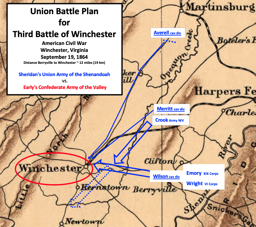
Map shows where the Union (blue) and Confederate (red) troops were as they were preparing for the Third Battle of Winchester (a.k.a. Opequon) in the American Civil War. (This is an 1876 map, and the railroad that runs through Winchester ended at Winchester in 1864.)
- Date
- 1876
- Mapmaker / publisher
- G.W. & C.B. Colton published map in 1876, modifications by TwoScarsUp in 2020. G.W. Colton died in 1901, and C.B. Colton died in 1916 according to RareMaps.com
- Place
- Virginia
- Archive
- Library of Congress (via Wikimedia Commons)
- Type
- map
- Original size
- 761 × 568 pixels
Public domainsafest
Reason: its maker died more than 70 years ago.
Read from: Commons licence category: PD-old-70-expired; no CC BY, CC BY-SA, GFDL or deletion tag on the file page.
Credit line
"Points of Interest in Third Winchester" (1876). G.W. & C.B. Colton published map in 1876, modifications by TwoScarsUp in 2020. G.W. Colton died in 1901, and C.B. Colton died in 1916 according to RareMaps.com. Library of Congress, Geography and Map Division, via Wikimedia Commons. Public domain. https://commons.wikimedia.org/wiki/File:Points_of_Interest_in_Third_Winchester.pngNeed maps for a whole project? Add Find Any Map to Claude and ask for this one by its id: 1776.
More like this

3rd Winchester Terrain and Positions
1895 · Wikimedia Commons

3rd Winchester 1 Infantry Beg
1895 · Wikimedia Commons

3rd Winchester Crook Gets Ready
1873 · Library of Congress

3rd Winchester VI and XIX Corps
1873 · Library of Congress
Union Plan Third Winchester
1912 · Library of Congress

3rd Winchester Wright VI Corps
1873 · Library of Congress

3rd Winchester Final Stand View from east
1873 · Library of Congress

Third Winchester - Afternoon Cavalry
1873 · Library of Congress