

3rd Winchester Terrain and Positions
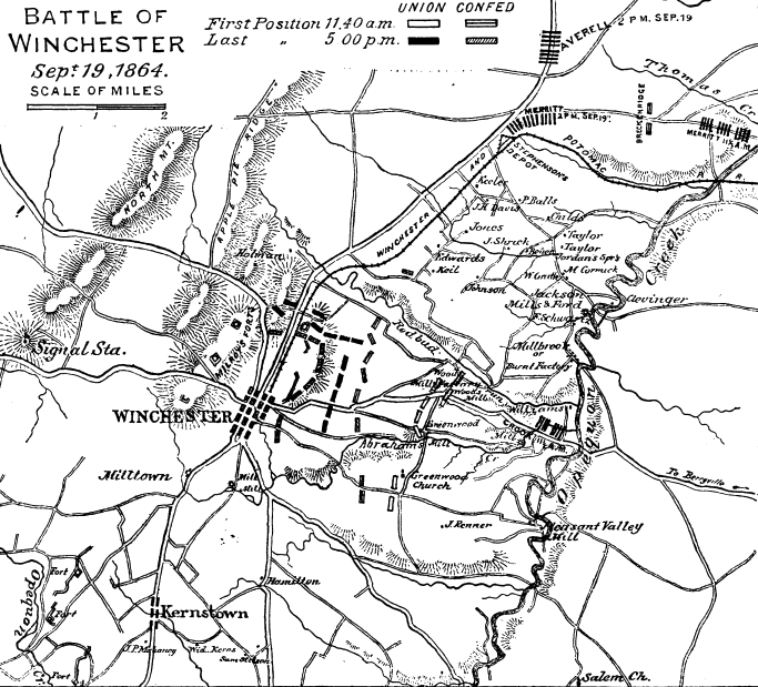
Union and Confederate positions prior to Union infantry attack in Third Battle of Winchester that occurred September 19, 1864. Confederate (red) units are divisions, while (blue) Union corps (and Crook) consist of two or three divisions each. Wilson is a cavalry division. Arrow points to important Berryville Pike and its "canyon". Although the Winchester & Potomac Railroad connected to the Baltimore & Ohio Railroad, it is mislabeled on this map since the B&O did not purchase the Winchester & Potomac until after the war.
- Date
- 1895
- Mapmaker / publisher
- Theodore F. Lang is the source book's author. TwoScarsUp added the color highlights
- Archive
- Wikimedia Commons
- Type
- map
- Original size
- 911 × 679 pixels
Public domainsafest
Reason: its maker died more than 70 years ago.
Read from: Commons licence category: PD-old-70-expired; no CC BY, CC BY-SA, GFDL or deletion tag on the file page.
Credit line
"3rd Winchester Terrain and Positions" (1895). Theodore F. Lang is the source book's author. TwoScarsUp added the color highlights, via Wikimedia Commons. Public domain. https://commons.wikimedia.org/wiki/File:3rd_Winchester_Terrain_and_Positions.pngNeed maps for a whole project? Add Find Any Map to Claude and ask for this one by its id: 1777.
More like this

3rd Winchester 1 Infantry Beg
1895 · Wikimedia Commons

Points of Interest in Third Winchester
1876 · Library of Congress

3rd Winchester 2 Crook Flank
1895 · Wikimedia Commons

3rd Winchester Map Noon
1914 · Library of Congress

3rd Winchester VI and XIX Corps
1873 · Library of Congress

3rd Winchester Crook Gets Ready
1873 · Library of Congress
Third Winchester 11-5 Positions
1888 · Wikimedia Commons

3rd Winchester Wright VI Corps
1873 · Library of Congress