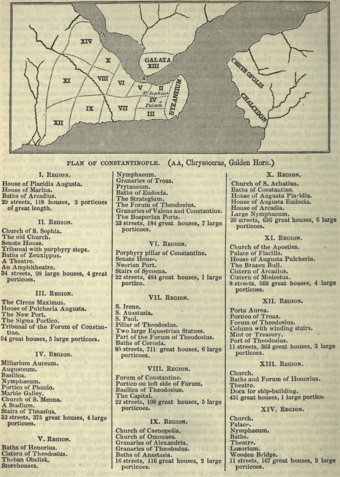

Plan of Constantinople
with its regions and the major buildings located in each, after the Notitia Urbis Constantinopolitanae of ca. 425 AD
- Date
- 1854
- Place
- Constantinople
- Archive
- Wikimedia Commons
- Type
- map
- Original size
- 1,084 × 1,521 pixels
Public domain
Reason: its maker died long enough ago that the copyright has expired.
This status rests on the map's publication history, as researched by Wikimedia Commons. Check it before commercial use.
Read from: Commons licence category: PD Old; no CC BY, CC BY-SA, GFDL or deletion tag on the file page.
Credit line
"Plan of Constantinople" (1854). Wikimedia Commons. Public domain. https://commons.wikimedia.org/wiki/File:Plan_of_Constantinople.PNGNeed maps for a whole project? Add Find Any Map to Claude and ask for this one by its id: 246194.
More like this

The delineation of Constantinople, as it stood in the year 1422 before it fell under the dominion of the Turks From du F - Gilles Pierre - 1729
1422 · Wikimedia Commons

Byzantium, nunc Constantinopolis
1635 · Constantinople, plate 2 of 3

Sketch map of Constantinople.
1911 · Wikimedia Commons

Constantinople 1840
1840 · Wikimedia Commons

Constantinople - Constantinopel
1840 · Wikimedia Commons

Bizansist touchup
Wikimedia Commons

Urbis Constantinopolitanae in XIV regiones divisae, qualis fuerit sub Honorio et Arcadio, necnon ejusdem suburbiorum delineatio / opera D. Anselmi Banduri; H. Van Loon, fecit
1711 · Wikimedia Commons

Byzantium Nunc Constantinopolis
c. 1660 · Wikimedia Commons