

Pjotr Tschaplin - Karte der Kamtschatka-Expedition
- Place
- the Russian Empire
- Archive
- Wikimedia Commons
- Type
- map
- Original size
- 3,000 × 1,313 pixels
Public domain
Reason: its maker died more than 100 years ago, and a faithful scan of a flat work adds no new copyright.
This status rests on the map's publication history, as researched by Wikimedia Commons. Check it before commercial use.
Read from: Commons licence category: PD-Art (PD-old-100); no CC BY, CC BY-SA, GFDL or deletion tag on the file page.
Credit line
"Pjotr Tschaplin - Karte der Kamtschatka-Expedition". Wikimedia Commons. Public domain. https://commons.wikimedia.org/wiki/File:Pjotr_Tschaplin_-_Karte_der_Kamtschatka-Expedition.jpgNeed maps for a whole project? Add Find Any Map to Claude and ask for this one by its id: 241605.
More like this

Map of Kamchatka 1755
1755 · Wikimedia Commons

A map of Kamtschatka engraved from the russian map by Tho Jefferys
Wikimedia Commons
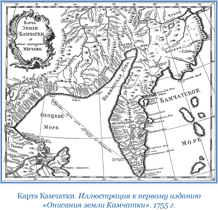
Карта Камчатки 1755
1755 · Wikimedia Commons

Kamtschatka-(Bering)
1681–1741 · Wikimedia Commons

Карта Камчатки Шестакова
1732 · Wikimedia Commons

MAP OF THE LANDS crossed by Captain Bering from the Town of TOBOLSK to KAMCHATKA" from the 1737 New Atlas of China, Chinese Tartary, and Tibet.
1737 · Siberia, plate 111 of 117

Anville Nouvel atlas de la Chine - Page108 - voyage beerings
1737 · Wikimedia Commons

Kamchatsky okrug and Kuril islands1826
1826 · Wikimedia Commons