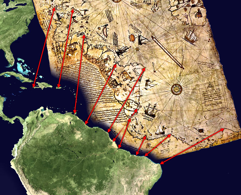

Piri Reis map interpretation RG
Possible interpretation of the Piri Reis map. Middle and south america on the left, north africa in the upper right, south atlantic ocean in the middle. An alternate (and more likely) interpretation of those ancient map can be found here:File:Piri Reis map interpretation.jpg
- Date
- March 29, 2006
- Mapmaker / publisher
- TMg, based on an image by Segantini
- Archive
- Wikimedia Commons
- Type
- map
- Original size
- 800 × 645 pixels
Public domain
Reason: public domain: self.
This status rests on the map's publication history, as researched by Wikimedia Commons. Check it before commercial use.
Read from: Commons licence category: PD-self; no CC BY, CC BY-SA, GFDL or deletion tag on the file page.
Credit line
"Piri Reis map interpretation RG" (March 29, 2006). TMg, based on an image by Segantini, via Wikimedia Commons. Public domain. https://commons.wikimedia.org/wiki/File:Piri_Reis_map_interpretation_RG.jpgNeed maps for a whole project? Add Find Any Map to Claude and ask for this one by its id: 307385.
More like this

1513 Piri Reis
c. 1513 · Wikimedia Commons

Piri reis world map 01
1513 · Wikimedia Commons

Piri Reis map interpretation
January 10, 2006 · Wikimedia Commons

Piri reis harita
Wikimedia Commons

Piri Reis map of Europe and the Mediterranean Sea-right-spaced
1525 · Wikimedia Commons

Pedro Reinel map
1504–1937 · Wikimedia Commons

World Map in a Double Hemisphere
Piri Reis

Oval Map of the World
Piri Reis