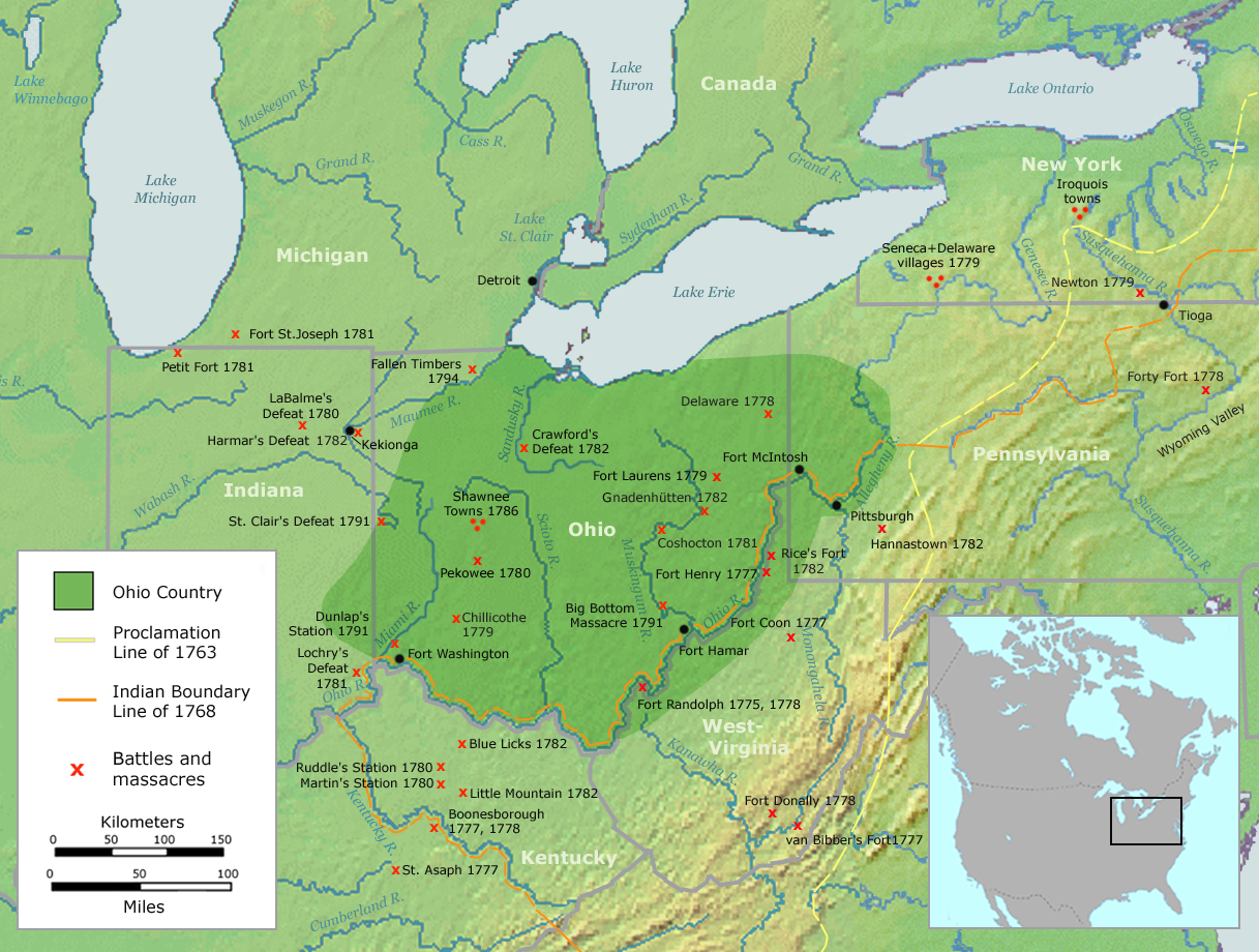

Ohio Country en
Map of the Ohio Country (English version)
- Date
- September 17, 2007
- Mapmaker / publisher
- User:Nikater
- Place
- the United States
- Archive
- Wikimedia Commons
- Type
- map
- Original size
- 1,217 × 920 pixels
Public domain
Reason: public domain: copyright holder.
This status rests on the map's publication history, as researched by Wikimedia Commons. Check it before commercial use.
Read from: Commons licence category: PD-copyright holder; no CC BY, CC BY-SA, GFDL or deletion tag on the file page.
Credit line
"Ohio Country en" (September 17, 2007). User:Nikater, via Wikimedia Commons. Public domain. https://commons.wikimedia.org/wiki/File:Ohio_Country_en.pngNeed maps for a whole project? Add Find Any Map to Claude and ask for this one by its id: 294063.
More like this

(A trader's map of the Ohio country before 1753.
1753 · Library of Congress

Tribal territory of Mascouten about 1650
January 27, 2013 · Wikimedia Commons

Map showing French occupation of the Ohio Valley - taken from Mr. Robert's Atlas universel, Paris 1755 - based on Christopher Gist's surveys made 1751
1882 · Library of Congress

The "Evans-Pownall" map of eastern North America.
c. 1755 · Library of Congress

Map by John Harris 1705 BHoU-p7
November 6, 2005 · Wikimedia Commons
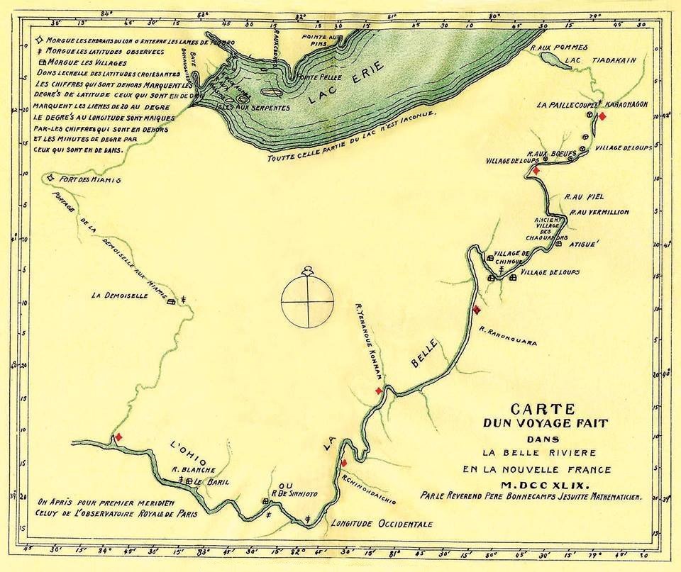
Carte d un voyage fait dans la Belle Riviere en la Nouvelle France M.DCC XLIX. Par le Reverend Pere Bonnecamps Jesuite Mathematicien
1749 · Wikimedia Commons

An accurate map of the English colonies in North America bordering on the River Ohio.
1754 · New York Public Library

Historical Atlas
1763–1923 · Wikimedia Commons