

NWIndia 1765 imperial gazeteer
Map from, "India 1765" from Imperial Gazetteer of India, 1909, Oxford University Press. Scanned from personal copy, cropped and annotated by me ( Fowler&fowler «Talk» 21:43, 18 March 2007 (UTC)), showing the region and environs of present-day Pakistan.
- Date
- March 18, 2007
- Mapmaker / publisher
- Imperial Gazetteer of India
- Place
- India in the 18th century
- Archive
- Wikimedia Commons
- Type
- map
- Original size
- 1,360 × 1,664 pixels
Public domain
Reason: public domain: user.
This status rests on the map's publication history, as researched by Wikimedia Commons. Check it before commercial use.
Read from: Commons licence category: PD-user; no CC BY, CC BY-SA, GFDL or deletion tag on the file page.
Credit line
"NWIndia 1765 imperial gazeteer" (March 18, 2007). Imperial Gazetteer of India, via Wikimedia Commons. Public domain. https://commons.wikimedia.org/wiki/File:NWIndia_1765_imperial_gazeteer.JPGNeed maps for a whole project? Add Find Any Map to Claude and ask for this one by its id: 257297.
More like this

NWIndia 1857 imperial gazeteer
1909 · Wikimedia Commons

NWIndia 1805 imperial gazeteer
1805 · Wikimedia Commons

Map of India under the British East India Company, comparing 1765 and 1805
1907 · Wikimedia Commons

NWBritish Indian Empire1909
1909 · Wikimedia Commons
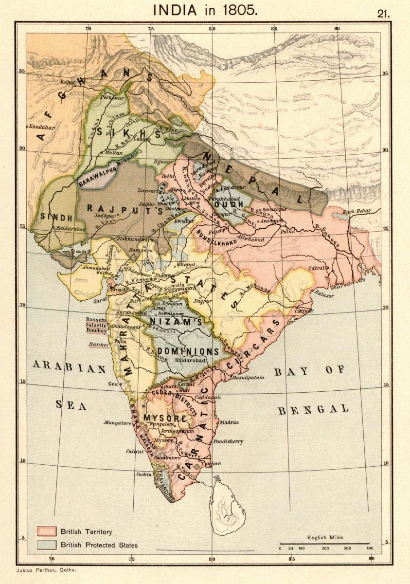
Map of India 1805 from:. Scanned from personal copy, reduced, uploaded by Fowler&fowler «Talk» 23:51, 24 February 2009 (UTC)
1907 · Wikimedia Commons

Political maps of India in the years 1765 and 1805, published in the 'Imperial Gazetteer of India' (Vol. XXVI, Atlas; 1931 revised edition; plate no. 28)
1931 · Wikimedia Commons

NWIndia 1837 imperial gazeteer
1837 · Wikimedia Commons

North Western Railway
November 11, 2016 · Wikimedia Commons