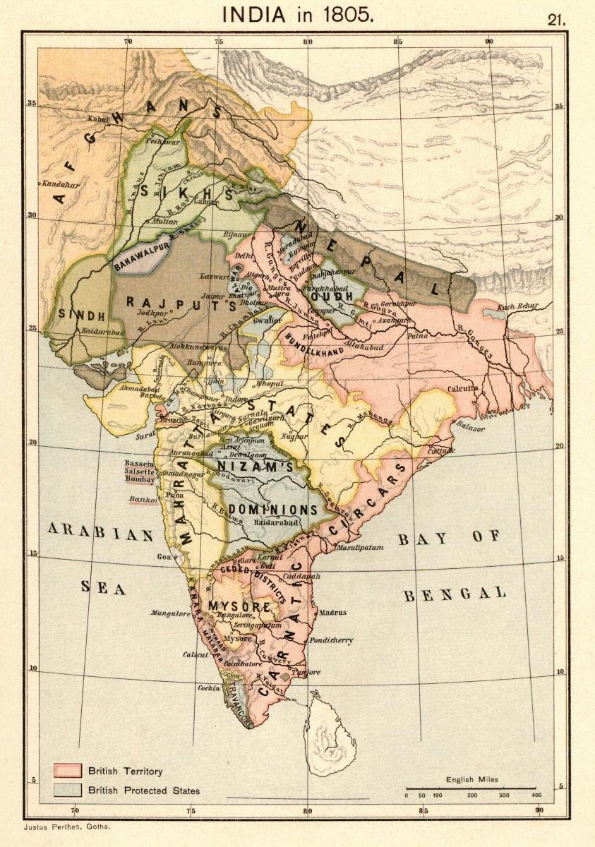

Map of India 1805 from:. Scanned from personal copy, reduced, uploaded by Fowler&fowler «Talk» 23:51, 24 February 2009 (UTC)
- Date
- 1907
- Mapmaker / publisher
- Justus Perthes, Gotha./Charles Joppen
- Place
- India in the 19th century
- Archive
- Wikimedia Commons
- Type
- atlas page
- Original size
- 843 × 1,200 pixels
Public domainsafest
Reason: its maker died more than 100 years ago.
Read from: Commons licence category: PD-old-100-expired; no CC BY, CC BY-SA, GFDL or deletion tag on the file page.
Credit line
"Map of India 1805 from:. Scanned from personal copy, reduced, uploaded by Fowler&fowler «Talk» 23:51, 24 February 2009 (UTC)" (1907). Justus Perthes, Gotha./Charles Joppen, via Wikimedia Commons. Public domain. https://commons.wikimedia.org/wiki/File:Joppen1907India1805a.jpgNeed maps for a whole project? Add Find Any Map to Claude and ask for this one by its id: 257269.
More like this

IGI1908India1857b-coloured Himalayan hill stations
1908 · Wikimedia Commons

IGI1908India1857b-coloured - Hill Stations
1908 · Wikimedia Commons

Map of "North-Western Provinces" from. Scanned from personal copy and uploaded by Fowler&fowler «Talk» 11:40, 7 March 2009 (UTC)
1880 · Wikimedia Commons

NWIndia 1765 imperial gazeteer
March 18, 2007 · Wikimedia Commons

NWIndia 1857 imperial gazeteer
1909 · Wikimedia Commons

Map of India under the British East India Company, comparing 1765 and 1805
1907 · Wikimedia Commons

Map of North-Western Provinces shown on that of the United Provinces from personal copy of the Imperial Gazetteer of India, volume 25 (Atlas), 1907. Scanned, labeled, famine region drawn, resized and
1907–2008 · Wikimedia Commons

Map from personal copy of Imperial Gazetteer of India, Volume 25 (Atlas) Oxford University Press, 1908. Re-labeled (to show the Doab in the United Provinces, cropped, and resized by Fowler&fowler «Tal
1908 · Wikimedia Commons