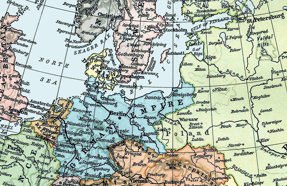

North and Baltic Seas, 1911
Map of the North and Baltic Seas in 1911.
- Date
- 1911
- Place
- Europe
- Archive
- Wikimedia Commons
- Type
- map
- Original size
- 960 × 625 pixels
Public domainsafest
Reason: its maker died more than 70 years ago.
Read from: Commons licence category: PD-old-70-expired; no CC BY, CC BY-SA, GFDL or deletion tag on the file page.
Credit line
"North and Baltic Seas, 1911" (1911). Wikimedia Commons. Public domain. https://commons.wikimedia.org/wiki/File:North_and_Baltic_Seas,_1911.pngNeed maps for a whole project? Add Find Any Map to Claude and ask for this one by its id: 251427.
More like this

Map of the North Sea
Wikimedia Commons

Strategical map of the North Sea and adjacent countries
Wikimedia Commons

International Regulation of the Fisheries on the High Seas
1910 · Wikimedia Commons

C. 1190 Scandinavia and Baltics
c. 1911 · Wikimedia Commons

C. 1911 Europe and Russia
c. 1911 · Wikimedia Commons

A chart of the NORTH SEA
1702 · New York Public Library

U-Bootskrieg - Die Sperrgebiete der europäischen Meere (North Sea crop)
1917 · Wikimedia Commons

A Generall chart of the NORTHERN SEAS. Describing the sea coast and Islands from France to Greene land
1702 · New York Public Library