

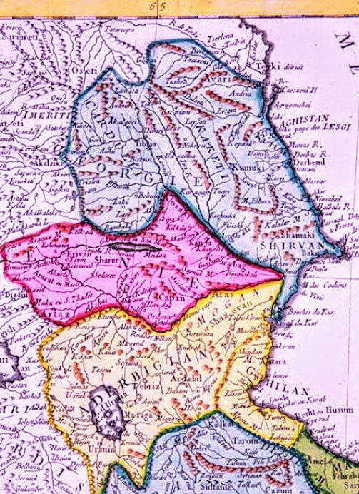
New and accurate map of Persia
A new & accurate map of Persia, with the adjacent countries: drawn from the most approved modern maps &c, the whole being regulated by astronl. observations / by Emanl. Bowen.
- Date
- 1747
- Place
- the Safavid Empire
- Archive
- Library of Congress (via Wikimedia Commons)
- Type
- map
- Original size
- 5,664 × 4,715 pixels
Public domainsafest
Reason: its maker died more than 100 years ago.
Read from: Commons licence category: PD-old-100-expired; no CC BY, CC BY-SA, GFDL or deletion tag on the file page.
Credit line
"New and accurate map of Persia" (1747). Library of Congress, Geography and Map Division, via Wikimedia Commons. Public domain. https://commons.wikimedia.org/wiki/File:New_and_accurate_map_of_Persia.jpgNeed maps for a whole project? Add Find Any Map to Claude and ask for this one by its id: 18477.
More like this

A new & accurate map of Persia, with the adjacent countries - drawn from the most approved modern maps etc. the whole being regulated by astronl. observations
1747 · Library of Congress

18th century map Imperii Persici
Wikimedia Commons

A new and accurate map of Turkey in Asia, Arabia &c
Wikimedia Commons

Jomann Imperium Periscum
1700–1720 · Wikimedia Commons

Imperii Percici delineatio
1722 · Wikimedia Commons

Persarum imperium.
1721 · Library of Congress
ARTAZ L' EMPIRE De PERSE 1779 d’Anville P.Santini ~3
1779 · Wikimedia Commons

Imperii Persici in omnes suas provincias nova tabula geographica
1724 · Library of Congress