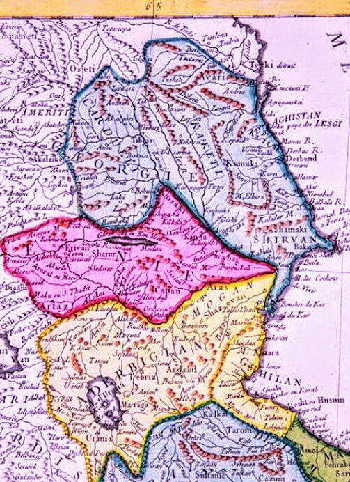

ARTAZ L' EMPIRE De PERSE 1779 d’Anville P.Santini ~3
North-West of the Persian empire
- Date
- 1779
- Mapmaker / publisher
- Jean Baptiste Bourguignon d'Anville (1697–1782) (French geographer) Paolo Santini (1729-1793), Giovanni Antonio Remondini (Venetian engravers)
- Place
- Azerbaijan
- Archive
- Wikimedia Commons
- Type
- map
- Original size
- 503 × 692 pixels
Public domain
Reason: its maker died long enough ago that the copyright has expired.
This status rests on the map's publication history, as researched by Wikimedia Commons. Check it before commercial use.
Read from: Commons licence category: PD Old; no CC BY, CC BY-SA, GFDL or deletion tag on the file page.
Credit line
"ARTAZ L' EMPIRE De PERSE 1779 d’Anville P.Santini ~3" (1779). Jean Baptiste Bourguignon d'Anville (1697–1782) (French geographer) Paolo Santini (1729-1793), Giovanni Antonio Remondini (Venetian engravers), via Wikimedia Commons. Public domain. https://commons.wikimedia.org/wiki/File:ARTAZ_L%27_EMPIRE_De_PERSE_1779_d%E2%80%99Anville_P.Santini_~3.jpgNeed maps for a whole project? Add Find Any Map to Claude and ask for this one by its id: 243388.
More like this

Jacques N. Bellin. The map of Armenia, Georgia and the neighbouring countries. 1764
1764 · Wikimedia Commons

Carte de l'Arménie, Géorgie et pays voisins
1764 · Map of Armenia, Georgia and neighbouring countries

Carte huilée de la Géorgie et de l'Arménie / de la main de Mr. d'Anville
1700–1799 · Wikimedia Commons

Imperii Percici delineatio
1722 · Wikimedia Commons

D'Anville. Carte huilée de la Géorgie et de l'Arménie.XVIIIe siècle.B
Wikimedia Commons

Johann Baptist Homann. Imperii Persici In Omnes Suas Provincias. Caucasus
1700–1720 · Wikimedia Commons

18th century map Imperii Persici
Wikimedia Commons

A new & accurate map of Persia, with the adjacent countries - drawn from the most approved modern maps etc. the whole being regulated by astronl. observations
1747 · Library of Congress