

Montour County, Pennsylvania.
Scale 1:50,000. Alternate title in right lower margin: Montour Co., Pa. At head of title: Commonwealth of Pennsylvania, Department of Environmental Resources, Topographic and Geologic Survey. "5000-meter universal transverse Mercator grid. " "Projection. (Lambert conformal conic)." Relief shown by contours and spot heights. "Experimental printing." "N4052.5--W7630/18X18." Includes index and location maps. AACR2
- Date
- 1974
- Mapmaker / publisher
- Geological Survey (U.S.); Pennsylvania. Bureau Of Topographic And Geologic Survey
- Place
- Montour County, Pennsylvania
- Scale
- 1:50,000
- Archive
- Library of Congress (via Wikimedia Commons)
- Type
- map
- Original size
- 7,205 × 9,616 pixels
Public domainsafest
Reason: a US government work.
Read from: Commons licence category: PD US Government; no CC BY, CC BY-SA, GFDL or deletion tag on the file page.
Credit line
"Montour County, Pennsylvania." (1974). Geological Survey (U.S.); Pennsylvania. Bureau Of Topographic And Geologic Survey. Library of Congress, Geography and Map Division, via Wikimedia Commons. Public domain. https://commons.wikimedia.org/wiki/File:Montour_County,_Pennsylvania._LOC_78690938.jpgNeed maps for a whole project? Add Find Any Map to Claude and ask for this one by its id: 18307.
More like this

Beaver County, Pennsylvania
1991 · Library of Congress

State of Pennsylvania.
1977 · Library of Congress
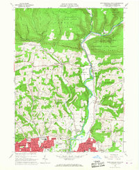
Montoursville North, Pennsylvania: USGS topographic map, 1:24,000 (1965–1999)
1965–1999 · 5 editions
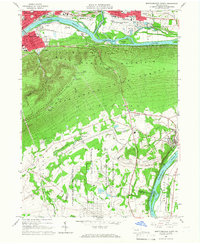
Montoursville South, Pennsylvania: USGS topographic map, 1:24,000 (1965–1994)
1965–1994 · 5 editions

Beaver County, Pennsylvania
1977 · Library of Congress

Snyder County, Pennsylvania
1986 · Library of Congress

Cummings' map of Columbia and Montour counties, Penn'a - from actual surveys
1860 · Library of Congress

Wyoming County, Pennsylvania
1987 · Library of Congress