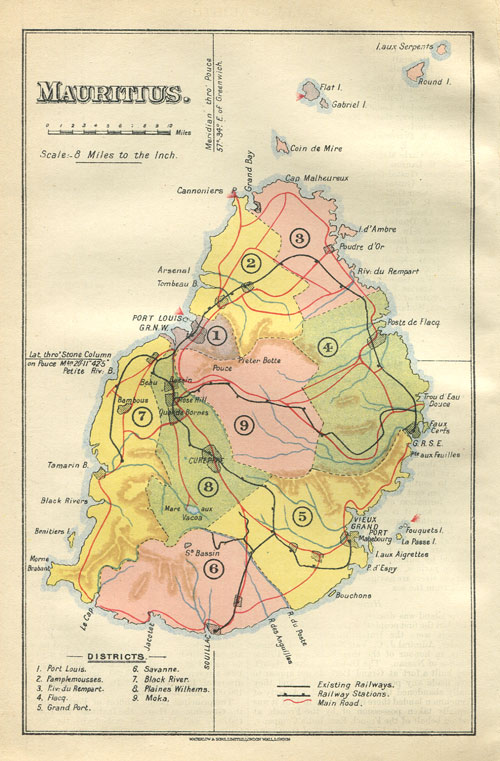

Mauritius Waterlow map 1910
Small coloured map of Mauritius showing roads and railways, printed by Waterlow & Sons, London, 1910.
- Date
- 1910
- Mapmaker / publisher
- not identified on map
- Place
- Mauritius
- Archive
- Wikimedia Commons
- Type
- map
- Original size
- 500 × 761 pixels
Public domain
Reason: public domain: UK.
This status rests on the map's publication history, as researched by Wikimedia Commons. Check it before commercial use.
Read from: Commons licence category: PD-UK; no CC BY, CC BY-SA, GFDL or deletion tag on the file page.
Credit line
"Mauritius Waterlow map 1910" (1910). not identified on map, via Wikimedia Commons. Public domain. https://commons.wikimedia.org/wiki/File:Mauritius_Waterlow_map_1910.jpgNeed maps for a whole project? Add Find Any Map to Claude and ask for this one by its id: 238974.
More like this

Map of Mauritius
1888 · Wikimedia Commons

Mauritius 1880 map by Descubes
1880 · Wikimedia Commons

Map of Mauritius
1901 · Wikimedia Commons

Le Tour du monde-07-p131
1863 · Mauritius, plate 131

Mare aux Songes
1869 · Wikimedia Commons

Dun Echt Volume 3 1885 Map of Mauritius
1885 · Wikimedia Commons

Ceylon (ca 1914)
1914 · Wikimedia Commons

MILBERT(1812) p021 - Carte Île-de-France
1812 · Wikimedia Commons