

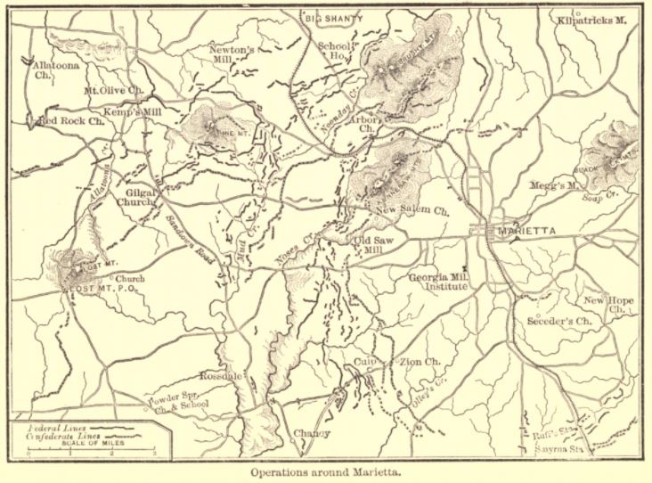
Marietta Georgia Vicinity Battles
Map of Kennesaw Mountain area
- Date
- 1864
- Mapmaker / publisher
- Matthews, Northrup & Co
- Archive
- Wikimedia Commons
- Type
- map
- Original size
- 1,033 × 993 pixels
Public domainsafest
Reason: its US copyright has expired (published before 1931).
Read from: Commons licence category: PD US expired; no CC BY, CC BY-SA, GFDL or deletion tag on the file page.
Credit line
"Marietta Georgia Vicinity Battles" (1864). Matthews, Northrup & Co, via Wikimedia Commons. Public domain. https://commons.wikimedia.org/wiki/File:Marietta_Georgia_Vicinity_Battles.jpgNeed maps for a whole project? Add Find Any Map to Claude and ask for this one by its id: 1248.
More like this

Map of Marietta and vicinity. (June 1864)
1864 · Library of Congress

Birds-eye map of the Western and Atlantic R.R., the great Kennesaw route; Army operations, Atlanta campaign, 1864.
1887 · Library of Congress
Cox map of Marietta operations
1882 · Wikimedia Commons

Map showing Approximate Position and Entrenchments of the Army of Miss. along the Chattahoochee and in the vicinities of Marietta and Dallas and Kennesaw and Lost Mountains Together with the respective positions occupied by Hardee's & Hood's Corps, Army Tenn., From May 25th to the 9th July 1864. E
c. 1864 · U.S. National Archives

Map of Atlanta and vicinity
1864 · Library of Congress

Information Map of Part of Georgia in the vicinity of Pumpkin Vine Creek. Printed at Engr. Office, Head-Q's. Dep't. of the Cumberland, in the field, May 30th, 1864.
May 30, 1864 · U.S. National Archives

Map(s) illustrating the military operations of the Atlanta campaign. 1864
1875 · Library of Congress

Atlanta 19 July- 26 August 1864
1875 · Wikimedia Commons