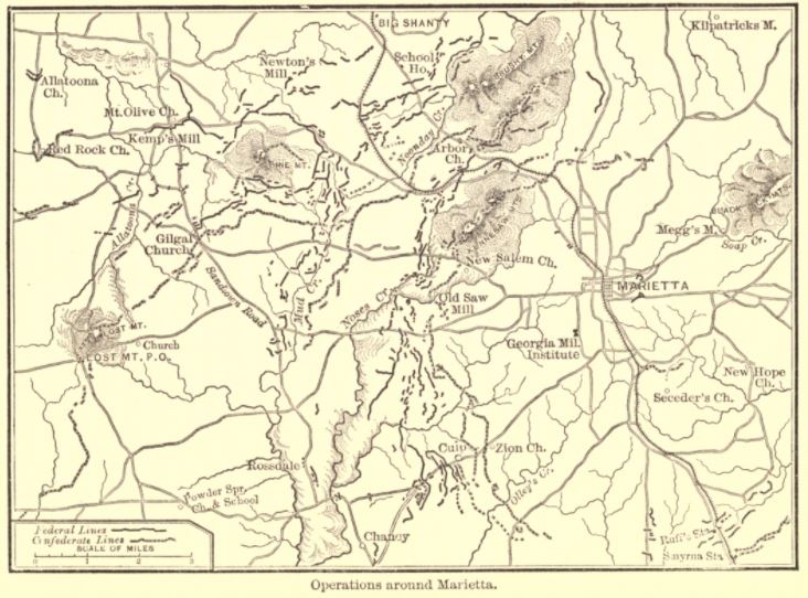

Cox map of Marietta operations
Sepia toned map labeled "Operations around Marietta" shows part of northern Georgia with Union and Confederate trench lines. From "Atlanta" by Jacob D. Cox (p. 90).
- Date
- 1882
- Mapmaker / publisher
- From Campaigns of the Civil War IX - Atlanta by Jacob D. Cox, published 1882, Charles Scribner's Sons, New York, NY
- Place
- Marietta, Georgia
- Archive
- Wikimedia Commons
- Type
- map
- Original size
- 732 × 542 pixels
Public domainsafest
Reason: its US copyright has expired (published before 1931).
Read from: Commons licence category: PD US expired; no CC BY, CC BY-SA, GFDL or deletion tag on the file page.
Credit line
"Cox map of Marietta operations" (1882). From Campaigns of the Civil War IX - Atlanta by Jacob D. Cox, published 1882, Charles Scribner's Sons, New York, NY, via Wikimedia Commons. Public domain. https://commons.wikimedia.org/wiki/File:Cox_map_of_Marietta_operations.jpgNeed maps for a whole project? Add Find Any Map to Claude and ask for this one by its id: 754.
More like this

Cox map of New Hope Church
1882 · Wikimedia Commons

Cox map of Resaca
1882 · Wikimedia Commons

Map of Marietta and vicinity. (June 1864)
1864 · Library of Congress

Cox map of Jonesboro
1882 · Wikimedia Commons

Map illustrating the siege of Atlanta, Ga. by the U.S. forces under command of Maj. Gen. W. T. Sherman, from the passage of Peach Tree Creek, July 19th 1864, to the commencement of the movement upon
1866 · Library of Congress

Map showing the operations of the national forces under the command of Maj. Gen. W.T. Sherman during the campaign resulting in the capture of Atlanta, Georgia, Sept. 1, 1864
1864 · Library of Congress

Map showing the operations of the national forces under the command of Maj. Gen. W.T. Sherman during the campaign resulting in the capture of Atlanta, Georgia, Sept. 1, 1864
May 6, 1864 · Library of Congress

Map(s) illustrating the military operations of the Atlanta campaign. 1864
1875 · Library of Congress