

Map of the Niger Country in 1898
Map of West Africa from "In the Niger Country" by Harold Bindloss (Edinburgh: W. Blackwood & Sons, 1898) Available at the British Library less
- Date
- 1898
- Mapmaker / publisher
- Book by Harold Bindloss, Map by John Bartholomew and Co
- Place
- Africa
- Archive
- Wikimedia Commons
- Type
- map
- Original size
- 3,760 × 1,989 pixels
Public domainsafest
Reason: its maker died more than 70 years ago.
Read from: Commons licence category: PD-old-70-expired; no CC BY, CC BY-SA, GFDL or deletion tag on the file page.
Credit line
"Map of the Niger Country in 1898" (1898). Book by Harold Bindloss, Map by John Bartholomew and Co, via Wikimedia Commons. Public domain. https://commons.wikimedia.org/wiki/File:Map_of_the_Niger_Country_in_1898.jpgNeed maps for a whole project? Add Find Any Map to Claude and ask for this one by its id: 237413.
More like this

Gold Coast Map 1896
1896 · Wikimedia Commons

Map showing European territorial claims in West Africa (1898) 01
1898 · Wikimedia Commons

Map showing European colonial territories in Africa
1898 · Wikimedia Commons
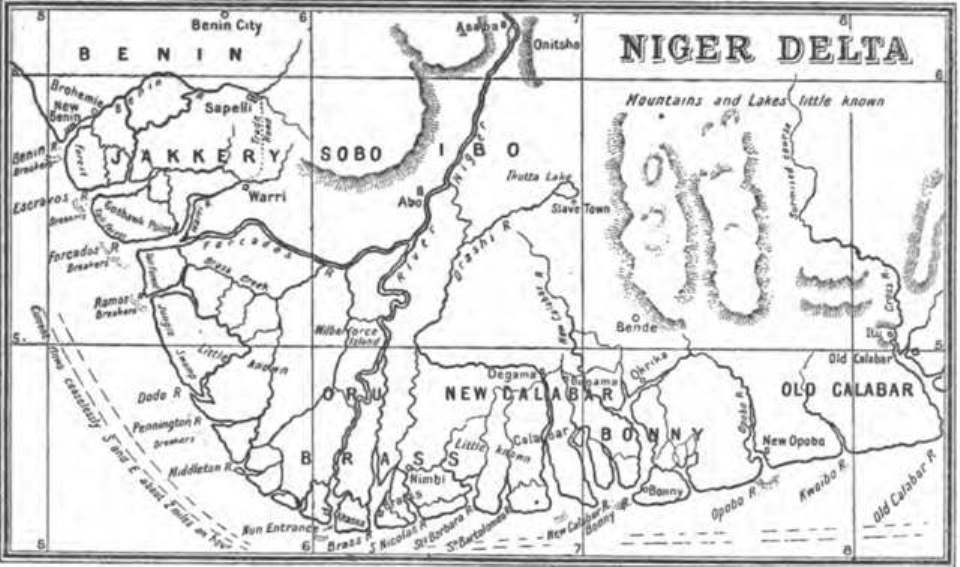
1898 Map of the Niger Delta by Harold Bindloss
1898 · Wikimedia Commons
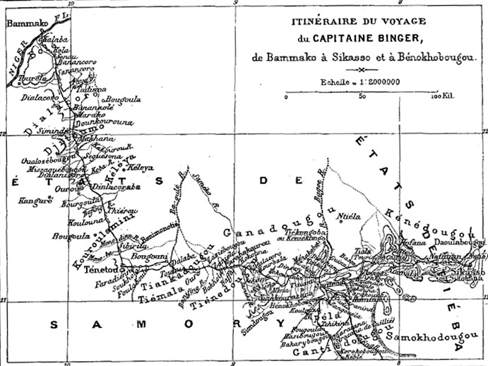
"Itinéraire du voyage du capitaine Binger, de Bammako à Sikasso et à Bénokhobougou", in Du Niger au golfe de Guinée (Louis-Gustave Binger), reproduit dans Le Tour du Monde, 1891, premier semestre, tom
1891 · Wikimedia Commons

"Map to Illustrate the Question of the Niger" (1:4,435,200). Detail of: Maps to Illustrate the Niger and Upper Nile Questions Author: W. & A. K. Johnston Publisher: Johnston, W. & A. K. Date: 1898 Loc
1898 · Wikimedia Commons

West Africa in a John Bartholomew & Co. map published c. 1914
c. 1914 · Wikimedia Commons

The Harmsworth atlas and Gazetter: 500 maps and diagrams in colour with commercial statistics and Gazetter index of 105 000 names
1908 · Africa