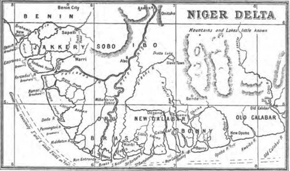

1898 Map of the Niger Delta by Harold Bindloss
- Date
- 1898
- Mapmaker / publisher
- In the Niger Country by Harold Bindloss
- Place
- Nigeria
- Archive
- Wikimedia Commons
- Type
- map
- Original size
- 960 × 567 pixels
Public domainsafest
Reason: its maker died more than 70 years ago.
Read from: Commons licence category: PD-old-70-expired; no CC BY, CC BY-SA, GFDL or deletion tag on the file page.
Credit line
"1898 Map of the Niger Delta by Harold Bindloss" (1898). In the Niger Country by Harold Bindloss, via Wikimedia Commons. Public domain. https://commons.wikimedia.org/wiki/File:1898_Map_of_the_Niger_Delta_by_Harold_Bindloss.jpgNeed maps for a whole project? Add Find Any Map to Claude and ask for this one by its id: 237042.
More like this

Mouths in the Niger Delta 1874
1876 · Wikimedia Commons

De Niger-Delta en de Cross-River volgens H.H. Johnston
1889 · Wikimedia Commons

AFR V3 D445 Bight of Biafra right side of the map
June 12, 1892 · Wikimedia Commons

Le Bas Niger
1896 · Wikimedia Commons

AFR V3 D345 Mouths of the Nun and Brass
June 12, 1892 · Wikimedia Commons

"Map to Illustrate the Question of the Niger" (1:4,435,200). Detail of: Maps to Illustrate the Niger and Upper Nile Questions Author: W. & A. K. Johnston Publisher: Johnston, W. & A. K. Date: 1898 Loc
1898 · Wikimedia Commons

Le Bas-Niger
1892 · Wikimedia Commons

HEARD(1898) Map of Liberia
1898 · Wikimedia Commons