

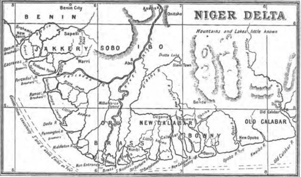
De Niger-Delta en de Cross-River volgens H.H. Johnston
1:4,000,000; On same page as ID#2024, 1744, 2012
- Date
- 1889
- Place
- Central Africa
- Archive
- Wikimedia Commons
- Type
- map
- Original size
- 630 × 1,000 pixels
Public domain
Reason: a US government work.
This status rests on the map's publication history, as researched by Wikimedia Commons. Check it before commercial use.
Read from: Commons licence category: PD US; no CC BY, CC BY-SA, GFDL or deletion tag on the file page.
Credit line
"De Niger-Delta en de Cross-River volgens H.H. Johnston" (1889). Wikimedia Commons. Public domain. https://commons.wikimedia.org/wiki/File:De_Niger-Delta_en_de_Cross-River_volgens_H.H._Johnston_-_DPLA_-_641d0e441fb429b742297ffb8d4379e9.jpgNeed maps for a whole project? Add Find Any Map to Claude and ask for this one by its id: 236528.
More like this

Congo River from its Mouth to Bolobo to illustrate the journeys of Mr. H. H. Johnston
1883 · Wikimedia Commons
1898 Map of the Niger Delta by Harold Bindloss
1898 · Wikimedia Commons

Map of the Cameroons District to illustrate the paper by Mr. George Greenfell
1882 · Wikimedia Commons

AFR V3 D445 Bight of Biafra right side of the map
June 12, 1892 · Wikimedia Commons

Le Bas-Niger
1892 · Wikimedia Commons

Map of Congo Free State and West Coast of Africa
1887 · Wikimedia Commons

Die westafrikanische Küste von Accra bis Ogowe
1885 · Wikimedia Commons

Map of Congo Free State and West Coast of Africa
1887 · Wikimedia Commons