

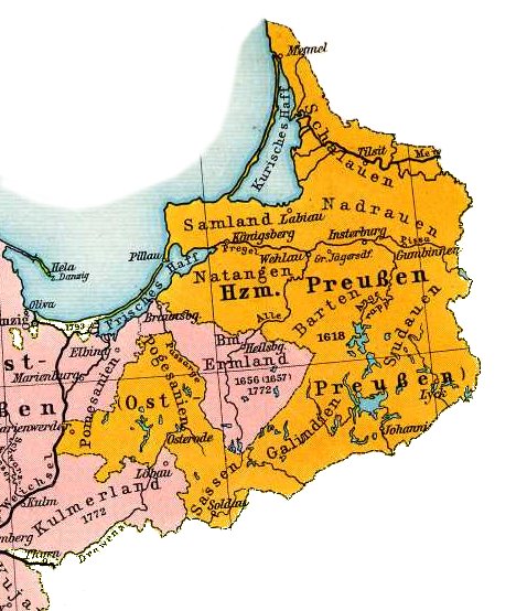
Map of East Prussia 1648
Friedrich Wilhelm Putzger: F. W. Putzgers Historischer Schul-Atlas: zur alten, mittleren und neuen Geschichte Bielefeld; Leipzig: Verlag von Velhagen & Klasing, nie przed 1905
- Date
- 1905
- Mapmaker / publisher
- Friedrich Wilhelm Putzger
- Place
- East Prussia
- Archive
- Wikimedia Commons
- Type
- atlas page
- Original size
- 1,748 × 2,152 pixels
Public domainsafest
Reason: its maker died more than 100 years ago.
Read from: Commons licence category: PD-old-100-expired; no CC BY, CC BY-SA, GFDL or deletion tag on the file page.
Credit line
"Map of East Prussia 1648" (1905). Friedrich Wilhelm Putzger, via Wikimedia Commons. Public domain. https://commons.wikimedia.org/wiki/File:Map_of_East_Prussia_1648_(135770689).jpgNeed maps for a whole project? Add Find Any Map to Claude and ask for this one by its id: 19650.
More like this
Map of East Prussia 1648
1905 · Wikimedia Commons

Zasięg diecezji sambijskiej przed objęciem biskupstwa przez Michaela Jung'a
1901 · Wikimedia Commons

(Putzger) Prussia, 1415-1806
1902 · Wikimedia Commons

F.W. Putzgers Historischer Schul-Atlas: zur alten, mittleren und neuen Geschichte: in 66 Haupt- und 63 Nebenkarten
Wikimedia Commons

Blaeu 1645 - Prussia
1645 · Wikimedia Commons

Cartes generales de toutes les parties du monde, ou les empires, monarchies, republiques, estats, peuples, &c. de l'Asie, de l'Afrique, de l'Europe, & de l'Americque, tant anciens que nouveaux, sont exactement remarqués, & distingués suivant leur estendue. Par le Sieur Sanson d'Abbeville, Geographe
1658 · Prussia, plate 220 of 388

Atlas sive Cosmographicae Meditationes de Fabrica Mundi et Fabricati Figura. Denuo auctus, by Gerhard Mercator, Jodocus Hondius, and Hendrik Hondius. Published in Amsterdam by Hendricus Hondius, 1623.
1623 · Prussia

Atlas Minor Gerardi Mercatoris a I. Hondio plurimis aeneis tabulis auctus atque illustratus.
Wikimedia Commons